


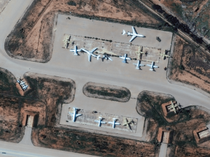
EUSI Upgrades German Ground Segment to Enable Europe’s Fastest Request-to-Receive Satellite Intelligence via Secure Web and API Platform for Defence and Emergency Agencies
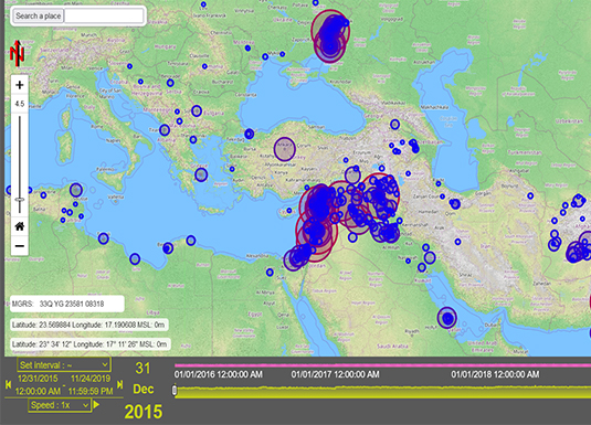
European Space Imaging (EUSI) announced a major upgrade of its satellite ground segment and cloud infrastructure, further accelerating its industry-leading satellite tasking and intelligence delivery capabilities through the secure ATOM™ web and API platform. The platform, in combination with EUSI’s Rapid Satellite Intelligence (RSINT) program, enables satellite tasking up to 30 minutes before image acquisition and delivery of imagery within 15 minutes of collection.
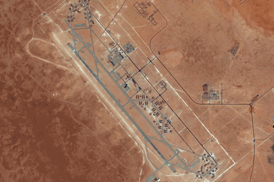
The Potential of WorldView Legion for the Safety and Security in Europe
In the ever-evolving landscape of global security, satellite imagery has become an indispensable tool for governments, organisations, and businesses worldwide. Many of them are now learning about the new opportunities that the six recently launched Vantor WorldView Legion satellites bring: higher border security, improved maritime surveillance, faster reaction to developing events, and much more.

Beginner’s Guide to Satellite Imagery: 10 Terms You Need to Know
Satellite imagery is an amazing but highly technical field with terms that might be hard to understand, especially for somebody with expertise in a completely different area. That’s why we are explaining the basics of satellite imagery in this article. What’s geolocational accuracy? What is the ideal off nadir angle? How can you see through clouds? Let’s dive right in.


