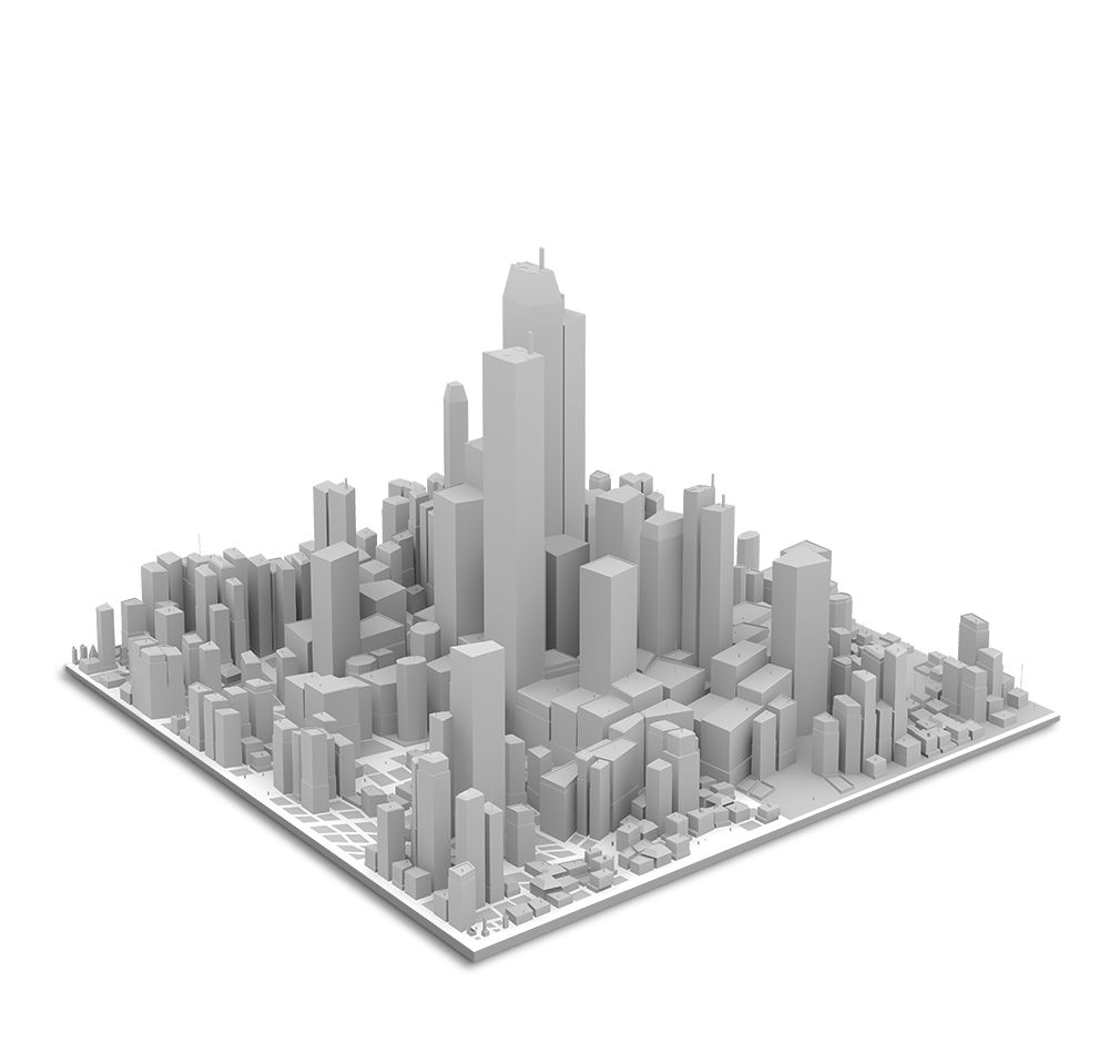
Not all data is created equal. Digital Elevation Models (DEM) and advanced 3D visualisations answer crucial questions, provide unique insights and give decision makers the data they require for success. Through partnerships with world leading geospatial services companies, we offer the world’s highest quality optical satellite-based 3D products and solutions.
Explore The surface
Rapid Production
For time sensitive projects in need of actionable data
Global Coverage
Fresh elevation data no matter where in the world
Guaranteed Accuracy
Resolution and precision for superior analysis
urbanpix3d
European Space Imaging together with GAF AG, has introduced the initiative to map all major European metro areas in 3D on a yearly basis.
For this initiative, called UrbanPix3D, we provide tri-stereo imagery at 30 cm resolution. We use these Off Nadir Angles:
European Space Imaging has partnered with GAF AG to offer this revolutionary elevation product. With RapidDEM, users can get fresh Very High Resolution (VHR) Digital Elevation Models (DEM) delivered 24 hours after collection.
Utilizing a sophisticated method whereby five VHR stereoscopic images are collected from varying angles on a single satellite pass, European Space Imaging is able to provide incredibly accurate elevation data and the highest quality 30 cm resolution textures to GAF AG, who then builds the 3D model and rush delivers it to the end user.
AW3D is the world’s first and the most precise 3D map covering all global land spaces with 5 meter resolution plus 50 cm resolution 3D models on demand.
Maxar’s technology enables imagery content to accurately represent all visible objects on the earth in 3D, and the products provide customers with unmatched value and utility, superior coverage relative to aerial-derived elevation models, and superior fidelity and availability relative to other satellite-derived models.
Available products include:
DSM – Global 50 cm surface model with high accuracy
DSM 10 – medium resolution surface model
True Ortho – orthorectified imagery without parallax or occlusion
This website uses cookies to improve your experience. We'll assume you're ok with this, but you can opt-out if you wish.DENYCUSTOMIZEACCEPT ALL
Privacy & Cookies Policy
Privacy Overview
This website uses cookies to improve your experience while you navigate through the website. Out of these cookies, the cookies that are categorized as necessary are stored on your browser as they are essential for the working of basic functionalities of the website. We also use third-party cookies that help us analyze and understand how you use this website. These cookies will be stored in your browser only with your consent. You also have the option to opt-out of these cookies. But opting out of some of these cookies may have an effect on your browsing experience.
Necessary cookies are absolutely essential for the website to function properly. This category only includes cookies that ensures basic functionalities and security features of the website. These cookies do not store any personal information.
Any cookies that may not be particularly necessary for the website to function and is used specifically to collect user personal data via analytics, ads, other embedded contents are termed as non-necessary cookies. It is mandatory to procure user consent prior to running these cookies on your website.
Architecture of ResNet34-UNet model
UNet architecture for semantic segmentation with ResNet34 as encoder or feature extraction part. ResNet34 is used as an encoder or feature extractor in the contracting path and the corresponding symmetric expanding path predicts the dense segmentation output.
Architecture of VGG16-UNet model
UNet architecture for semantic segmentation with VGG16 as the encoder or feature extractor. VGG16 is used as an encoder or feature extractor in the contracting path and the corresponding symmetric expanding path predicts the dense segmentation output.
Architecture of ResNet34-FCN model
In this model, ResNet34 is used for feature extraction and the FCN operation remains as is. The feature of ResNet architecture is exploited where just like VGG, as the number of filters double, the feature map size gets halved. This gives a similarity to VGG and ResNet architecture while supporting deeper architecture and addressing the issue of vanishing gradients while also being faster. The fully connected layer at the output of ResNet34 is not used and instead converted to fully convolutional layer by means of 1×1 convolution.
Architecture of VGG16-FCN model
In this model, VGG16 is used for feature extraction which also performs the function of an encoder. The fully connected layer of the VGG16 is not used and instead converted to fully convolutional layer by means of 1×1 convolution.