Data may be the most valuable resource in the world, but without the proper tools to manage and analyse that data, it falls short of its full potential. We have teamed up with the most trusted geospatial value-added service companies in the world, to offer an array of software options to optimize raster and vector data ingestion, storage, processing and analysis for any application.
Data at full Potential
Access & Ingest imagery
Stream and download the entire Maxar archive via web browser or API
Big Data Management
A platform to store and instantly recall your raster and vector data
AI Enhanced Analytics
Identify equipment, monitor change, extract features, annotate and more
ATOM BY EUROPEAN SPACE IMAGING
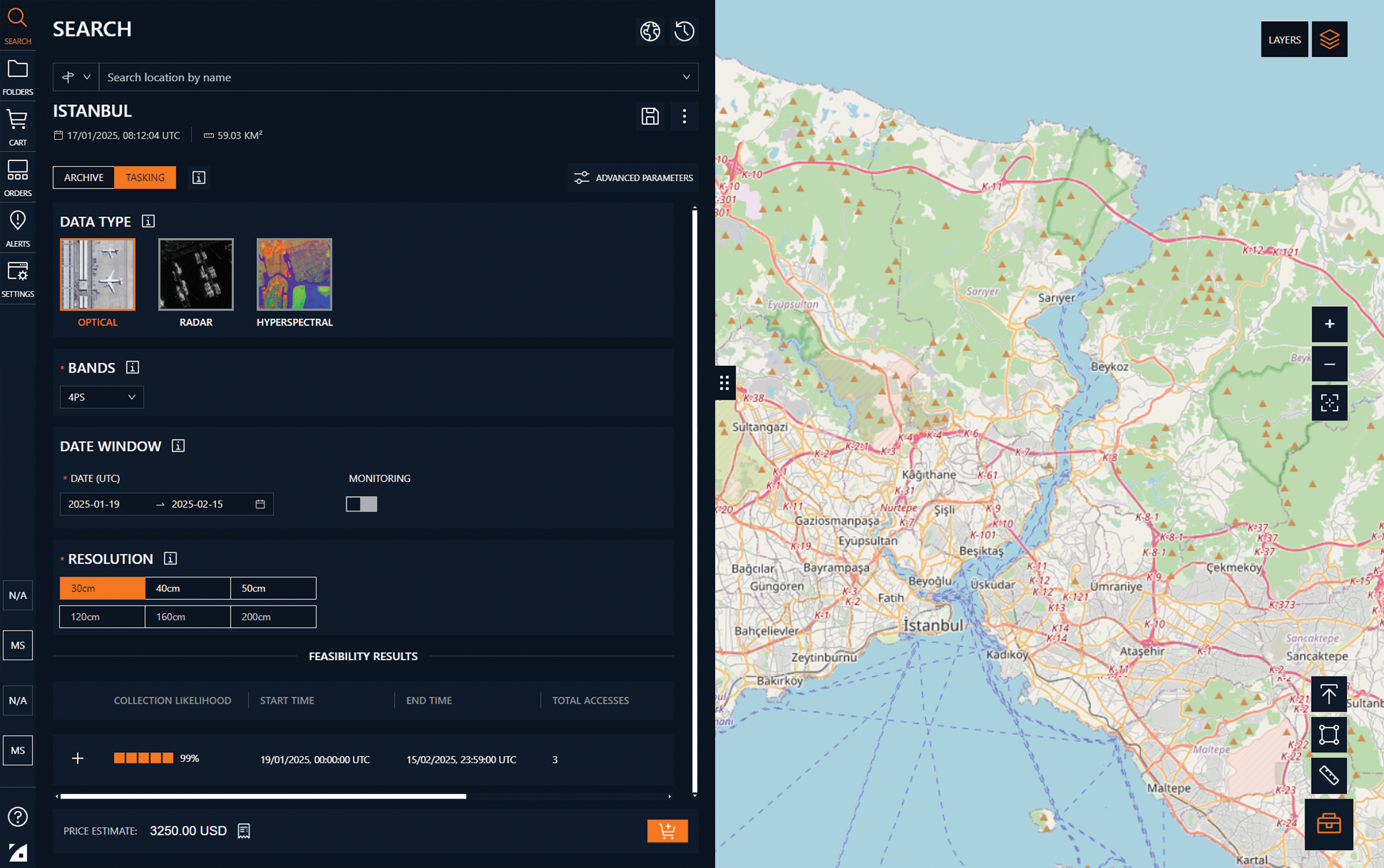
ATOM is a powerful virtual tasking platform for the world’s highest quality satellite imagery. Accessible 24/7/365 via web or API, it provides complete control over imagery collection and delivery. It features a wide range of input parameters and live feasibility results for the world’s most advanced satellites. Users can access it via browser or API, with multiple datasets available, tasking and archive ordering. The service is entirely free to use, with no fees or subscriptions, and offers extensive options for production and order management.
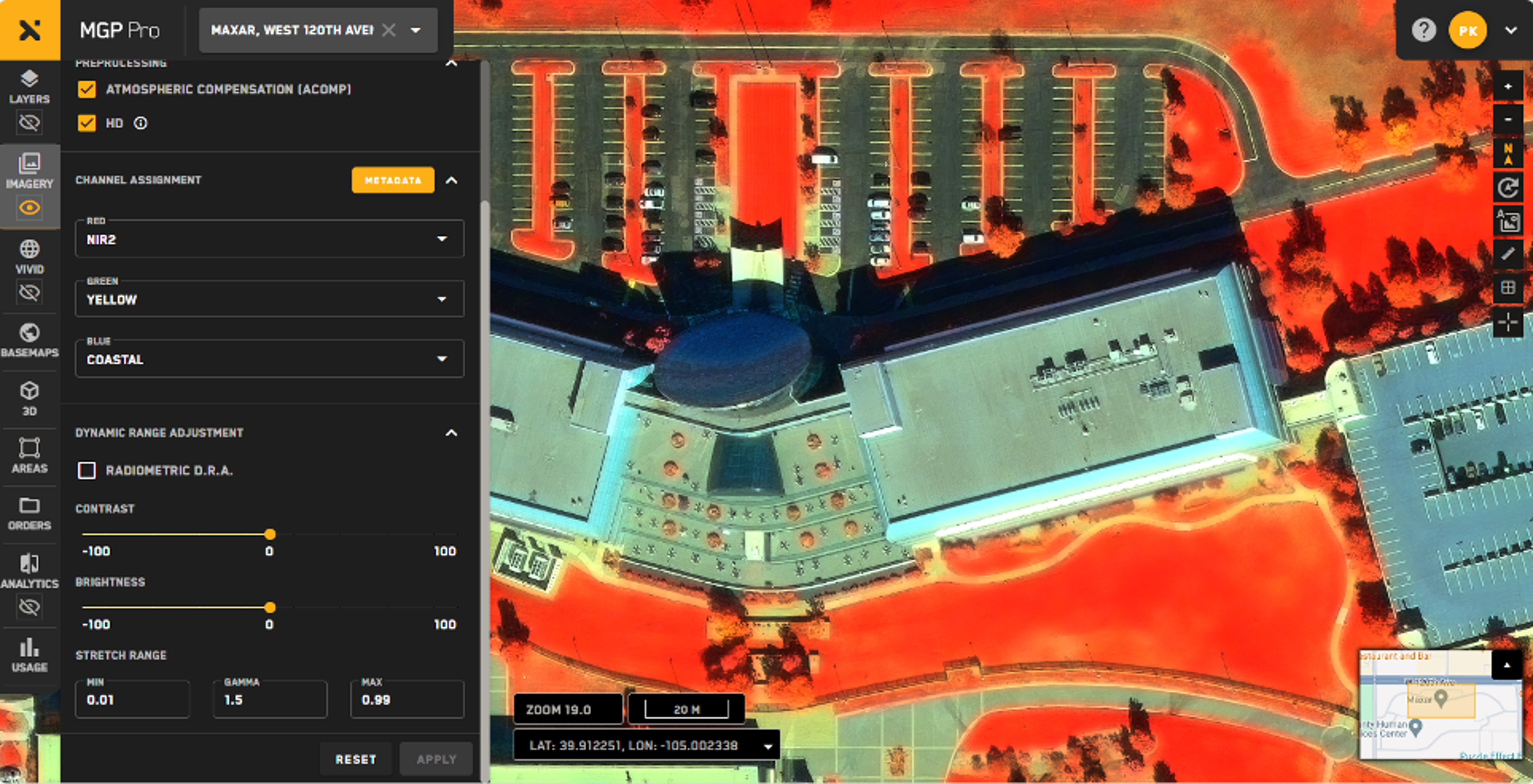
MGP Pro is the premier, cloud-based subscription platform for secure and timely access to Earth Intelligence. With a broad range of imagery and geospatial data products, MGP Pro provides unrivaled coverage, quality and flexibility. MGP Pro subscribers can access over 3 million square kilometers of daily image collections, plus more than 6 billion sq km of archived imagery at up to 30 cm resolution.
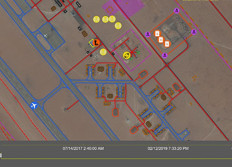
Geo4i’s GeoSpace is a dedicated GEOINT & IMINT platform for processing and analysing geospatial imagery and Big Data. The platform is NATO STANAG 3569 compliant featuring automated detection workflows and other value-added tools that allows for reporting and analysis.
Help4i provides accurate, intuitive and easy to understand identification of civilian and military equipment with more than 6,000 items registered in the GeoSpace platform. With just a few measurements, you can refine the search to a list of potential candidates matching the equipment to be identified with functionality to overlap and compare models and thereby improve the confidence of the identification.
Ecopia Global Feature Extraction (GFX) Powered by European Space Imaging utilises the freshest, highest quality satellite imagery along with the most advanced artificial intelligence from Ecopia.AI (Ecopia) to offer accurate extraction of 13 core geospatial feature at continent-wide scale.
The resulting vector maps are delivered as easy-to-use shapefiles, enabling users to focus on necessary analytics rather than time-consuming map making.
A SecureWatch subscription gives you instant access to the best satellite imagery and geospatial data via web browser or API integration; And you don’t have to be an imagery expert or have in-house tools. SecureWatch is designed to make both fresh and archive imagery accessible to anyone who needs it, whether you’re concerned with a specific area or the entire globe.
This website uses cookies to improve your experience. We'll assume you're ok with this, but you can opt-out if you wish.DENYCUSTOMIZEACCEPT ALL
Privacy & Cookies Policy
Privacy Overview
This website uses cookies to improve your experience while you navigate through the website. Out of these cookies, the cookies that are categorized as necessary are stored on your browser as they are essential for the working of basic functionalities of the website. We also use third-party cookies that help us analyze and understand how you use this website. These cookies will be stored in your browser only with your consent. You also have the option to opt-out of these cookies. But opting out of some of these cookies may have an effect on your browsing experience.
Necessary cookies are absolutely essential for the website to function properly. This category only includes cookies that ensures basic functionalities and security features of the website. These cookies do not store any personal information.
Any cookies that may not be particularly necessary for the website to function and is used specifically to collect user personal data via analytics, ads, other embedded contents are termed as non-necessary cookies. It is mandatory to procure user consent prior to running these cookies on your website.
Architecture of ResNet34-UNet model
UNet architecture for semantic segmentation with ResNet34 as encoder or feature extraction part. ResNet34 is used as an encoder or feature extractor in the contracting path and the corresponding symmetric expanding path predicts the dense segmentation output.
Architecture of VGG16-UNet model
UNet architecture for semantic segmentation with VGG16 as the encoder or feature extractor. VGG16 is used as an encoder or feature extractor in the contracting path and the corresponding symmetric expanding path predicts the dense segmentation output.
Architecture of ResNet34-FCN model
In this model, ResNet34 is used for feature extraction and the FCN operation remains as is. The feature of ResNet architecture is exploited where just like VGG, as the number of filters double, the feature map size gets halved. This gives a similarity to VGG and ResNet architecture while supporting deeper architecture and addressing the issue of vanishing gradients while also being faster. The fully connected layer at the output of ResNet34 is not used and instead converted to fully convolutional layer by means of 1×1 convolution.
Architecture of VGG16-FCN model
In this model, VGG16 is used for feature extraction which also performs the function of an encoder. The fully connected layer of the VGG16 is not used and instead converted to fully convolutional layer by means of 1×1 convolution.