Seeing More in a Single Day: The Value of Intraday Satellite Collections
- Zuzana Hajkova, Content Marketing Coordinator, EUSI
Imagine a convoy moves between 08:00 and 11:00. Or morning clouds clear by 14:00, revealing new activity. Or a structure appears at 09:30 that wasn’t visible at 07:00. If you’re working with once-daily satellite passes, you miss all of this. With intraday collections, you see it happen.
Modern satellite constellations offer several collection opportunities per day. This means you can see the same location under different conditions – with different lighting, shadows, texture or clouds – at different times of the day. In situations where timing and conditions evolve quickly, this capability becomes critical. How do intraday satellite collections work and why are they so valuable for analysis, monitoring, and decision-making?
What are intraday collections?
Intraday satellite collections refer to capturing the same area multiple times within a single day. Instead of getting one image per day at a predetermined time, you receive several images taken at different times – hours or even minutes apart. Each collection shows the location under different lighting angles, weather conditions, or activity states, enabling more reliable analysis and faster decision-making.
💡 This parameter is also referred to as revisit rate or temporal resolution (one of three important resolution parameters, alongside spatial and spectral resolution).
Satellite imagery © 2026 Vantor Provided by European Space Imaging
Who needs intraday satellite collections?
Intraday collections make the biggest difference when timing affects your decisions and when a single daily image leaves too many gaps.
Defence and security analysts track force movements, facility construction, and border activity that happens between standard collection times. When units move at 14:00 and you only have passes at 10:00 and the following morning, you’re working with 20-hour-old intelligence. Intraday coverage cuts that gap.
Emergency response teams watch disasters that change faster than daily satellites can track them. A flood expands. A fire spreads. A landslide blocks new routes. Multiple collections in a day show you the progression and give you up-to-date information to act on.
Infrastructure operators monitor construction sites, pipelines, ports, and facilities where unauthorised activity or damage can appear and disappear within a single day. A vehicle appears at 08:00, unloads at 12:00, and leaves by 17:00. One daily pass might catch it, might miss it entirely, or might show the result without showing what happened.
Other applications include:
- Environmental and compliance teams need proof of activity during specific windows.
- Insurance and legal teams benefit from detailed temporal records – multiple images from the same day can prove when damage occurred, whether conditions were as reported, and what activities took place.
- Urban planners and civil government users monitor parking lots to see how busy they are throughout the day.
- Any projects in cloudy areas have a higher chance of receiving cloud-free imagery if several collection opportunities are available every day.
Why can some satellite operators provide intraday coverage and others can’t?
Not all satellite operators can provide meaningful intraday coverage. It requires three specific capabilities:
Constellation size: More satellites mean more passes. A single satellite in sun-synchronous orbit might pass over your location once per day at roughly the same time. Ten satellites in varied orbits create multiple opportunities throughout the day.
Orbit diversity: Most Very High Resolution (VHR) satellites use sun-synchronous orbits, which means they image the same location at approximately the same local time each day. Adding satellites in mid-inclination orbits changes this. Mid-inclination satellites pass over locations at varying times throughout the day, multiplying collection opportunities and capturing scenes under different sun angles.
Tasking flexibility: Automated systems can schedule collections, but experienced teams are needed to evaluate weather windows, off-nadir angles, and other parameters to maximise the quality of imagery. Without this, you might get 15 scheduled collections but only 3 usable images.
EUSI operates 10 optical satellites across both sun-synchronous and mid-inclination orbits, which provides up to 15 optical collection opportunities per day, depending on location. Additionally, we have partnered with Umbra to add SAR satellites with 6–12 hour revisit rates, which means coverage continues at night and through cloud cover.
For you, this translates to more collection opportunities, better scheduling flexibility, and a higher probability of getting usable imagery when weather or timing is difficult.
Different daytimes, different qualities. How does collection time affect texture and shadows in satellite images?
The sun’s position changes throughout the day, which directly affects how satellite images look and what details they reveal. Two of the most notable differences are shadows and texture.
Shadows as a challenge – or an opportunity?
With different sun elevation angles, shadows have different sizes and directions. This matters because western shadows at 07:00 hide what eastern shadows at 16:00 reveal, and vice versa. That comes in useful when analysts want to see a particular detail that would be covered by a shadow in one part of the day but is visible at a different time.
Images with shadows in opposite directions are useful for shadow masking in both satellite-based maps and 3D models, where tall buildings normally create challenges by casting long shadows that obscure nearby features.
The example below shows a village in Libya. However, how exactly the time of collection affects the imagery will vary depending on location, mostly due to differences in the atmosphere.


💡 Contrast, hue, haze and other parameters will vary depending on location, mostly due to differences in the atmosphere.
Texture and surface detail across the day
Low sun angles light scenes from the side rather than from above, which is why early-morning or late–afternoon satellite images show texture detail more clearly than midday images. This can reveal vehicle tracks in the mud or sand, small vegetation, or rough surfaces.
The satellite image collected at 8:34 am shows ground texture more clearly than the image collected around mid-day. Satellite imagery © 2026 Vantor Provided by European Space Imaging
How do intraday collections help in cloudy regions?
For areas with frequent cloud cover, a higher revisit rate leads to better chances of capturing cloud-free imagery. If morning clouds block the view, Collection Planners can attempt acquisitions at different times of day when gaps appear. Since the weather is unpredictable, this doesn’t guarantee clear skies – but it significantly improves your probability of avoiding clouds. At EUSI, we factor weather predictions and real-time cloud patterns into our Intelligent Collection Planning process. When one collection window is clouded, we assess other opportunities throughout the day to find clear windows.
Higher intraday revisit rates mean that collection planning can adapt dynamically to changing weather conditions. Instead of relying on a single acquisition window, multiple collection opportunities throughout the day significantly increase the likelihood of delivering cloud-free imagery. Satellite imagery © 2026 Vantor Provided by European Space Imaging
Don’t act on outdated information. Intraday monitoring of developing situations
When situations change by the hour, acting on outdated imagery creates risk. Intraday collections let analysts work with current information, track developments within the same day, and increase confidence in assessments and response actions. Decisions become faster and better.
“Additional satellite collections during emergencies such as wildfires, floods, or landslides are especially valuable, as conditions can change significantly within hours. Multiple acquisitions within a single day can improve the information available to responders, enabling them to track the progression of an event in greater detail, assess changes in extent and intensity, and adapt response plans accordingly. Access to up-to-date satellite imagery allows decision-makers to improve resource allocation, evacuation planning, and coordination.”
Dr. Monika Gähler, Head of ZKI (Center for Satellite Based Crisis Information) at DLR
The images below show an example from August 2025 when wildfires hit Portugal. Intraday monitoring captured fire progression around a village near Arganil with visible differences between 11:06 and 11:41 am. A single daily pass would have shown either “before fire” or “after fire” – not the rate of spread that determines if you can evacuate. Later collection, after the fire passed, showed the extent of damage and affected areas for assessment and recovery planning.


Why combine intraday optical satellite imagery with SAR?
Optical satellites provide visual detail such as colour, texture, and identifiable features. But they rely on daylight and clear skies. SAR satellites collect data at night and through clouds, providing reliable coverage when optical collections are limited. Together, they give you 24-hour awareness. You can monitor fast-moving or weather-dependent situations without losing critical information.
Pair an optical image captured at 14:00 with a SAR acquisition at 22:00. The optical image shows detail: what vehicles, what structures, what’s visible on the ground. The SAR image shows change detection: what moved, what appeared, and what activity occurred after dark.
“In security and defence contexts, understanding when a change occurred can be as important as identifying the change itself. Intraday satellite collections reduce temporal gaps between observations, enabling analysts to detect, confirm, or rule out activity within hours rather than days. When combined with SAR imagery, intraday optical collections support persistent situational awareness and ensure coverage even in cloudy conditions or outside daylight hours.”
Valerio Gulli, Senior Business Development Manager at EUSI
By offering both Very High Resolution optical imagery and access to SAR acquisitions within the same operational framework, EUSI enables continuous monitoring across varying conditions. You don’t need to coordinate multiple providers to maintain continuous situational awareness over a 24-hour period.
Intraday collections + Near Real-Time Delivery + Dynamic Tasking
Near real-time (NRT) delivery means receiving satellite imagery minutes after collection, not hours later. EUSI is currently the only Very High Resolution satellite imagery provider able to contractually deliver NRT satellite imagery as fast as 15 minutes after collection, even for parallel orders. This matters because you’re not analysing this morning’s situation at 17:00 – you’re looking at images from 16:45 while the situation is still developing. Moreover, you can take advantage of EUSI’s Dynamic Tasking and schedule the collection last minute – up to 30 minutes before the satellite pass.
Combine intraday collections with Dynamic Tasking and NRT delivery: you get multiple 30 cm images of your location per day, each delivered 15 minutes after collection. You make decisions based on reliable near real-time information about the development of the event, without having to set foot on the scene. Regardless of what you are monitoring:
- borders
- floods
- energy infrastructure
- illegal activity
- landslides
- military bases
- ports
- much more
How to get started with intraday collections
At EUSI, you have the flexibility to choose the parameters of your collections as well as the project workflow.
- If you prefer guidance: Tell us the details of your project and our Customer Support will guide you through everything. Collection Managers will plan the most effective collection schedule based on your location, timing requirements, weather patterns, and image quality needs.
- If you prefer independence: Define your parameters and task your own collections through our online interface ATOM – with customisable parameters, live feasibilities, and last-minute tasking options.
The combination of expert support and self-service flexibility results in the best possible intraday coverage with minimal effort on your side, and both approaches give you access to the same constellation and capabilities: up to 15 optical passes per day, SAR options for night and cloud coverage, last-minute satellite tasking and 15-minute NRT delivery when you need it. Explore your options and talk to us about your project: connect@euspaceimaging.com
Frequently asked questions about intraday satellite collections
1. What are intraday satellite collections?
Intraday satellite collections mean capturing the same area multiple times within a single day. This provides several up-to-date views of a location under different lighting and environmental conditions, rather than relying on just one daily collection.
2. What is revisit rate?
Also called temporal resolution, revisit rate indicates how often a satellite constellation can image a specific location. A two-hour revisit rate means the constellation passes over your area every two hours.
3. Why does revisit rate matter for satellite imagery?
A higher revisit rate reduces the time gap between observations. This is critical for monitoring fast-moving events, avoiding cloud cover, and ensuring decisions are based on current information rather than outdated imagery.
4. Why do lighting conditions matter in satellite images?
Sun position affects shadows, texture, and surface visibility. Morning and evening images show more texture and cast long shadows that reveal ground detail. Midday images have shorter shadows and less texture but provide clearer overhead views. Different times reveal different features.
5. Who benefits from intraday satellite imagery?
Intraday satellite imagery is especially useful for emergency responders, infrastructure operators, defence and security analysts, environmental agencies, and insurance teams dealing with rapidly changing situations.
6. How do intraday collections help in cloudy areas?
Multiple collection opportunities throughout the day increase the chances of acquiring cloud-free imagery. If morning cloud blocks the view, afternoon or evening collections may find clear windows. More attempts mean better probability of high-quality results.
7. Can intraday optical images work with SAR imagery?
Yes. Optical imagery provides visual detail but requires daylight and clear skies. SAR imagery works at night and through clouds. Pairing both within the same day gives you 24-hour coverage and continuous monitoring regardless of weather or darkness.
8. How fast can intraday satellite imagery be delivered?
EUSI can deliver satellite imagery up to 15 minutes after collection – this is called Near Real Time (NRT) delivery. Multiple images per day, each delivered within minutes of capture, means you’re working with current information while situations are still developing.
9. Are intraday collections only useful during emergencies?
No. While they are critical during disasters, intraday collections are also valuable for infrastructure monitoring, environmental compliance, security applications, and any other projects where timing and reliability matter.
10. Does orbit diversity affect collection timing?
Yes. Sun-synchronous satellites pass over locations at roughly the same local time each day. Mid-inclination orbit satellites pass at varying times, creating multiple collection opportunities throughout the day and capturing scenes under different solar angles.
11. Why do some satellite operators provide intraday coverage and others don't?
Intraday coverage requires three things: constellation size (more satellites create more passes), orbit diversity (including satellites in mid-inclined orbits that pass over the same area at different times of day), and operational flexibility (experienced teams optimising collection plans around weather and imaging conditions). Not all operators have this combination of capabilities.
Related Stories

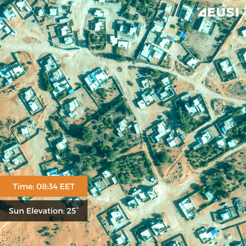
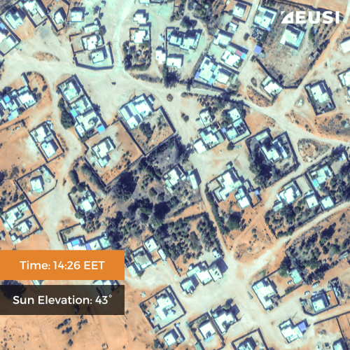
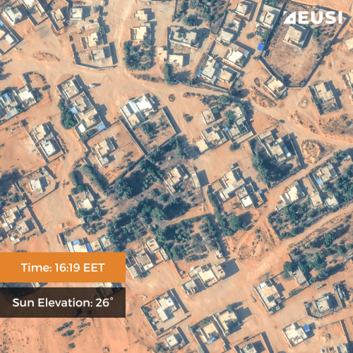
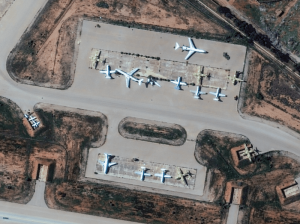
GEOSeries: Maintaining Temporal Control of Developing Situations With Rapid Satellite Tasking and Intraday Imaging
In the fast-moving operational environments of security monitoring and emergency response, the value of satellite data is defined by when it arrives, not just its resolution or accuracy. This webinar explores how Dynamic Tasking enables users to access actionable data fast and operate within mission decision windows.

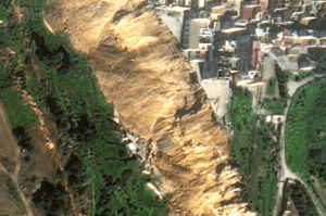
VHR Satellite Images Show Damage After Niscemi Landslide
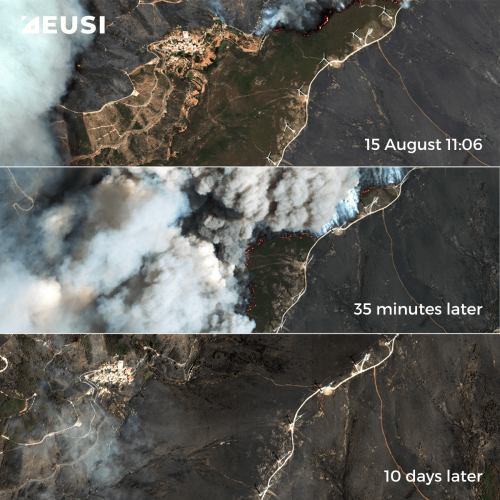
In January 2026, Italy declared state of emergency after being hit by Cyclone Harry – a storm that brought 10-metre waves and torrential rains of over 300 mm in 48 hours. The most severely affected regions were Sicily, Calabria and Sardinia, with the damage in Sicily alone estimated to be more than 1.5 billion euros. EUSI collected Very High Resolution satellite imagery of the affected areas, including Niscemi – a Sicilian town hit by a massive landslide.

The Potential of WorldView Legion for the Safety and Security in Europe
In the ever-evolving landscape of global security, satellite imagery has become an indispensable tool for governments, organisations, and businesses worldwide. Many of them are now learning about the new opportunities that the six recently launched Vantor WorldView Legion satellites bring: higher border security, improved maritime surveillance, faster reaction to developing events, and much more.

Beginner’s Guide to Satellite Imagery: 10 Terms You Need to Know
Satellite imagery is an amazing but highly technical field with terms that might be hard to understand, especially for somebody with expertise in a completely different area. That’s why we are explaining the basics of satellite imagery in this article. What’s geolocational accuracy? What is the ideal off nadir angle? How can you see through clouds? Let’s dive right in.