

Habitat Preservation Using Satellite Imagery
- European Space Imaging
The Hartibaciu Tableland encompasses about 2,500 square kilometers in central Romania and is home to many rare species of birds, flora, and fauna. It is an area susceptible to flooding and landslides, is subject to development pressure, and is experiencing population growth. The World Wildlife Fund (WWF), in cooperation with the Danube Carpathian program and European Union, commissioned a geographic survey to create land management plan for the region.
Preserving the Habitat of Unique Species
Nearly 50 percent of Romania is covered by natural and semi-natural ecosystems. The country contains some of the largest undisturbed forest land in all of Europe and is home to about 400 unique species of mammals, birds, reptiles, and amphibians. At 2,500 square kilometers, the Hartibaciu region is an important site for habitat preservation. The World Wildlife Fund will use the data derived from this survey to create a land management plan to identify preservation strategies for the region moving forward over the next ten years.
Muncons SRL Tapped by WWF for Project
Muncons SRL has been a WorldView Global Alliance reseller for three years. Muncons serves dozens of customers in government, defense and intelligence, mining, natural resources, oil and gas, and humanitarian and conservation agencies. When the WWF was seeking a partner to complete a topographical survey of the Hartibaciu region, it chose Muncons for its deep experience in high-resolution imagery projects. The ultimate goal of the project is to create land management plans and develop territorial planning guidelines in the region by integrating the components of biodiversity, conservation in territorial development, and natural resource use.
Building a Framework for Land Management
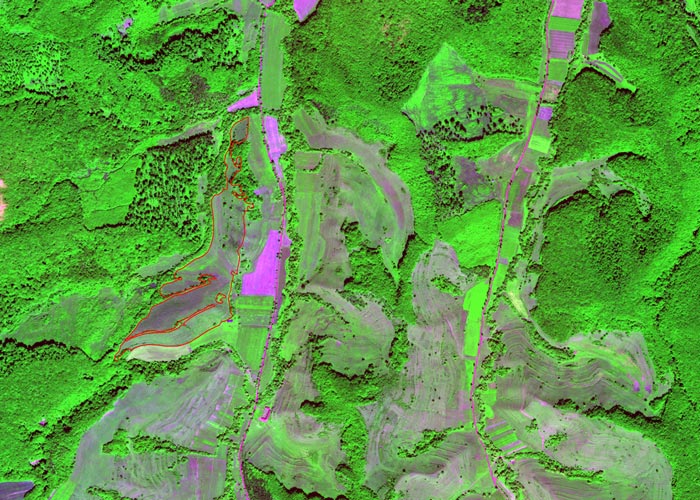
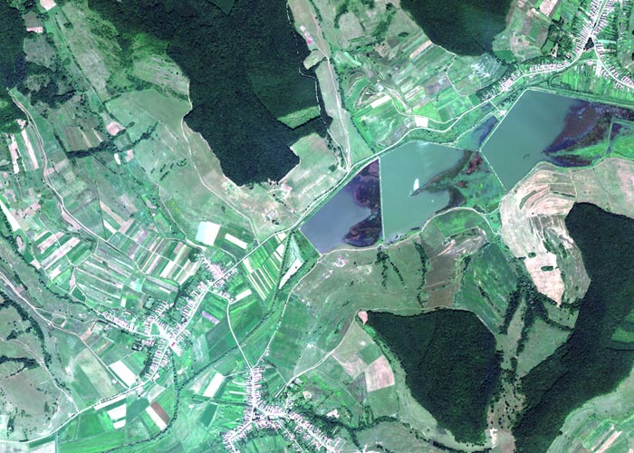
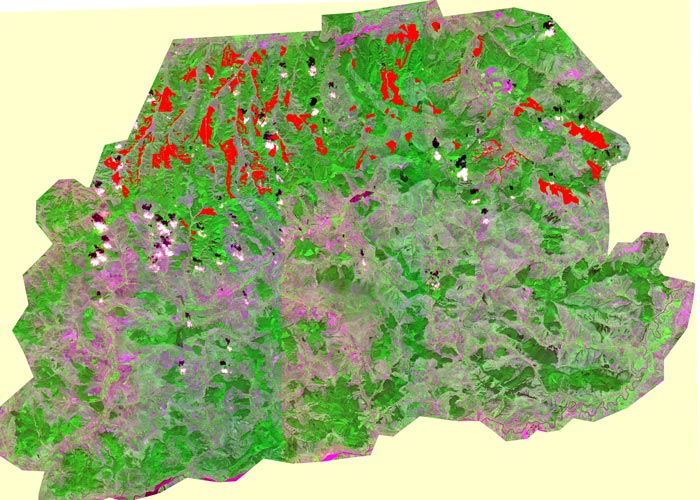
To build the necessary framework for proper management and preservation of the land, species, and habitats, Muncons deployed DigitalGlobe’s WorldView-2 8-band multispectral satellite. The resulting images were used for automatic and semi-automatic habitat classification, including land, water courses, infrastructure, and developed areas such as buildings, roads and industrial zones.
Muncons also created an integrated GIS solution to map species and habitats. The supplemental web portal included interactive maps of endangered species distribution, areas of vegetation, agriculture, preservation lands and environmental hazards.
“The goal was to create a comprehensive solution that the WWF, Nature 2000 and other stakeholders could use to create a far-reaching land management plan that could be used in many ways to promote conservation and preservation,” says Horia Munteanu, Director, Muncons SRL.
A Cost-Effective Solution
The use of WorldView-2’s high-resolution multispectral imagery and automatic image analysis resulted in rapid classification of habitats. The World Wildlife Fund was able to save a significant amount of money because fewer field specialists were required to complete the project.
"We provided authorities, investors and other stakeholders with a tool that allowed them to quickly, easily, and cost-effectively identify areas of endangered animal and vegetative species. We are clearly achieving the goals of increasing the involvement of a variety of stakeholders to create a land management plan to protect the environmental integrity of the region."
HORIA MUNTEANU, Director, Muncons SRL
Challenge
Create a solution to provide various stakeholders with the data and tools to create a comprehensive land management plan to protect the sensitive habitat of Romania’s Hartibaciu region.
Solution
Muncons SRL deployed WorldView-2 high-resolution satellite imagery with an integrated GIS solution and web portal to develop a land management plan used by a variety of takeholders.
Results
An accurate, cost-effective solution that has been used by the WWF and Natura 2000, the EU’s nature and biodiversity policy group to raise awareness of the environmental sensitivities of the region.
ABOUT MUNCONS SRL
Muncons SRL, a WorldView Global Alliance authorized reseller for the past three years, serves dozens of customers in government, defense and intelligence, mining, natural resources, oil and gas, and humanitarian and conservation agencies.
Related Stories

Earth Observation Turns Ecological Targets into Measurable Outcomes: How Satellite Imagery Supports Compliance with Europe’s Nature Restoration Regulation
The EU’s Nature Restoration Regulation (NRR) entered into force in 2024 and set legally binding targets to restore degraded ecosystems across Europe. With National Restoration Plans due in September 2026, Member States face an urgent question: how do you map, plan and monitor restoration across millions of hectares in a consistent, verifiable way? Earth Observation (EO) – and Very High Resolution (VHR) multispectral satellite imagery in particular – is increasingly the answer.

EUSI Upgrades German Ground Segment to Enable Europe’s Fastest Request-to-Receive Satellite Intelligence via Secure Web and API Platform for Defence and Emergency Agencies
European Space Imaging (EUSI) announced a major upgrade of its satellite ground segment and cloud infrastructure, further accelerating its industry-leading satellite tasking and intelligence delivery capabilities through the secure ATOM™ web and API platform. The platform, in combination with EUSI’s Rapid Satellite Intelligence (RSINT) program, enables satellite tasking up to 30 minutes before image acquisition and delivery of imagery within 15 minutes of collection.


Maritime Domain Awareness in European Arctic Regions With VHR Satellite Intelligence
With the Arctic warming nearly four times faster than the average, the ice in the High North is melting and the sea is becoming increasingly navigable. In 2025 alone, 1812 vessels entered the Arctic Polar Code area, which is a 40% increase since 2013 when data collection began. While this rise in traffic presents potential commercial opportunities, more vessels also mean more risks to people and resources.

Seeing More in a Single Day: The Value of Intraday Satellite Collections
Imagine a convoy moves between 08:00 and 11:00. Or morning clouds clear by 14:00, revealing new activity. Or a structure appears at 09:30 that wasn’t visible at 07:00. If you’re working with once-daily satellite passes, you miss all of this. With intraday collections, you see it happen.




