

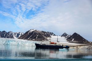
Maritime Domain Awareness in European Arctic Regions With VHR Satellite Intelligence
With the Arctic warming nearly four times faster than the average, the ice in the High North is melting and the sea is becoming increasingly navigable. In 2025 alone, 1812 vessels entered the Arctic Polar Code area, which is a 40% increase since 2013 when data collection began. While this rise in traffic presents potential commercial opportunities, more vessels also mean more risks to people and resources.
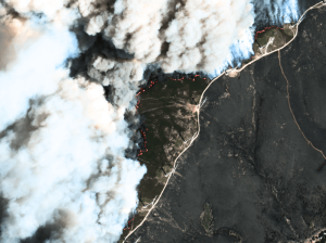
Seeing More in a Single Day: The Value of Intraday Satellite Collections
Imagine a convoy moves between 08:00 and 11:00. Or morning clouds clear by 14:00, revealing new activity. Or a structure appears at 09:30 that wasn’t visible at 07:00. If you’re working with once-daily satellite passes, you miss all of this. With intraday collections, you see it happen.
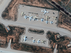
The Potential of WorldView Legion for the Safety and Security in Europe
In the ever-evolving landscape of global security, satellite imagery has become an indispensable tool for governments, organisations, and businesses worldwide. Many of them are now learning about the new opportunities that the six recently launched Vantor WorldView Legion satellites bring: higher border security, improved maritime surveillance, faster reaction to developing events, and much more.


