

Satellogic successfully launches 10 new satellites expanding European Space Imaging’s satellite access portfolio

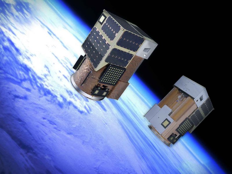
On Friday 6 November, Satellogic, the first company to develop a scalable Earth observation platform with the ability to remap the entire planet at both high-frequency and high-resolution, announced the successful dedicated launch of 10 new satellites to their Aleph-1 constellation.

These 10 new satellites expands the company’s data-delivery capabilities, securing Satellogic’s place as a global leader in high-resolution data collection from space. The increased orbital capacity enables access to up to four daily revisits of any point of interest globally and the collection of more than 4 million sq. km per day in Very High Resolution (VHR) imagery. Satellogic’s in-orbit fleet is now comprised of 21 satellites, 14 of which are used to deliver VHR data to customers.

“Timely access to geospatial analytics enables governments and key decision makers to build resilient processes and maintain their competitive edge, particularly in times of uncertainty or dramatic change,” said Satellogic Founder and CEO, Emiliano Kargieman. “We’re excited to put the power of our growing constellation directly in the hands of our customers and empower them to make better decisions, supported by up-to-date and high-resolution geospatial imagery.”

Lorem ipsum dolor sit amet, consectetur adipiscing elit. Ut elit tellus, luctus nec ullamcorper mattis, pulvinar dapibus leo.

Satellogic’s newest generation of satellites operates at 0.7 meter resolution, enabling a more detailed view of the globe for more precise decision making. Through their partnership as part of the Global Consortium of Geospatial Imagery, European Space Imaging will have access to these satellites to provide their customers with high resolution, high frequency and affordable geospatial data. Each of the spacecraft carries both sub-meter multispectral and a 29-band hyperspectral sensor. These satellites complement the company’s existing offer of Very High Resolution satellite imagery at True 30 cm resolution allowing European Space Imaging to provide data to suit every customers’ needs.

“We are extremely excited at the success of this launch for Satellogic and what it means for our partnership,” said Adrian Zevenbergen, Managing Director at European Space Imaging. “These satellites significantly expand our capacity to provide imagery to the European market. With further satellite launches to the Aleph-1 constellation planned for the future, our offering becomes stronger and stronger thus opening up a new era of opportunities at European Space Imaging”.

Through their innovative partnerships, European Space Imaging now has access to 25 orbiting satellites at resolutions of 30 cm – 1 m and with a combined daily revisit of close to 10 times per day. The data from the Satellogic satellites will be accessible by European Space Imaging, supplementing their already extensive archive of satellite imagery dating back to 1999 further cementing the companies’ reputation for being a leader in premium satellite imagery within Europe.

About Satellogic

Satellogic is the first vertically integrated geospatial analytics company driving real outcomes for its customers with planetary-scale insights they can trust.

Our low-Earth-orbit satellite constellation, platform, and data science teams work together to deliver high-frequency, high resolution, end-to-end solutions at the right price point. The company makes sense of the data so customers can focus on the big decisions at hand.

With more than 190 satellite engineers, AI experts, and solution specialists, Satellogic is on a mission to deliver a fundamentally better picture of the planet and the many forces that reshape it every day. The company bring space down to earth for large enterprises and governments of all sizes who need to see for themselves how our world is changing.

Satellogic. Now you see. To learn more, please visit: www.satellogic.com

Related Stories

Nature Restoration

Earth Observation Turns Ecological Targets into Measurable Outcomes: How Satellite Imagery Supports Compliance with Europe’s Nature Restoration Regulation

The EU’s Nature Restoration Regulation (NRR) entered into force in 2024 and set legally binding targets to restore degraded ecosystems across Europe. With National Restoration Plans due in September 2026, Member States face an urgent question: how do you map, plan and monitor restoration across millions of hectares in a consistent, verifiable way? Earth Observation (EO) – and Very High Resolution (VHR) multispectral satellite imagery in particular – is increasingly the answer.

Read More »
satellite antenna

EUSI Upgrades German Ground Segment to Enable Europe’s Fastest Request-to-Receive Satellite Intelligence via Secure Web and API Platform for Defence and Emergency Agencies

European Space Imaging (EUSI) announced a major upgrade of its satellite ground segment and cloud infrastructure, further accelerating its industry-leading satellite tasking and intelligence delivery capabilities through the secure ATOM™ web and API platform. The platform, in combination with EUSI’s Rapid Satellite Intelligence (RSINT) program, enables satellite tasking up to 30 minutes before image acquisition and delivery of imagery within 15 minutes of collection.


Read More »
Ship in Arctic waters

Maritime Domain Awareness in European Arctic Regions With VHR Satellite Intelligence 

With the Arctic warming nearly four times faster than the average, the ice in the High North is melting and the sea is becoming increasingly navigable. In 2025 alone, 1812 vessels entered the Arctic Polar Code area, which is a 40% increase since 2013 when data collection began. While this rise in traffic presents potential commercial opportunities, more vessels also mean more risks to people and resources.

Read More »




