

Portugal Wildfires: Rapid Delivery of Satellite Imagery in Emergency Situations
- European Space Imaging
European Space Imaging accepted overnight orders to deliver Very High Resolution satellite imagery for the Copernicus Emergency Management Service (EMS) in response to devastating wildfires in Portugal.
Dozens have been injured and hundreds displaced as multiple massive fires burn in central Portugal. As firefighters battle day and night, European Space Imaging works around the clock to collect and deliver current Very High Resolution (VHR) satellite imagery that is crucial for emergency responders to make informed decisions. These images were ordered by the Copernicus EMS to create maps for emergency responders, so they can assess their strategies on a daily basic.
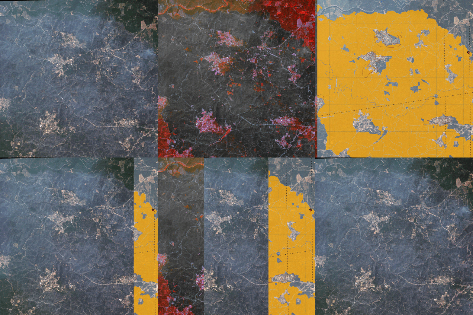
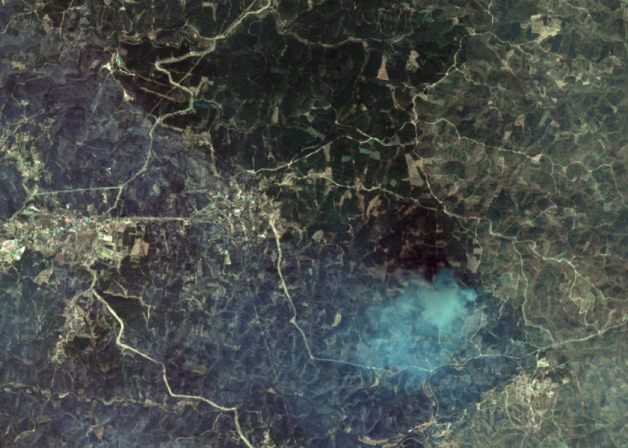
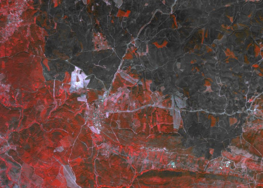
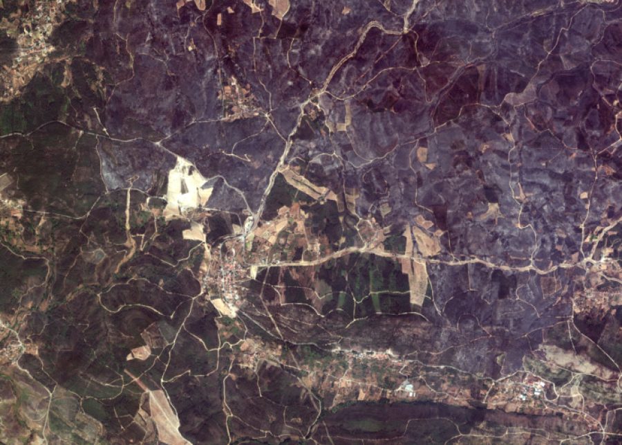
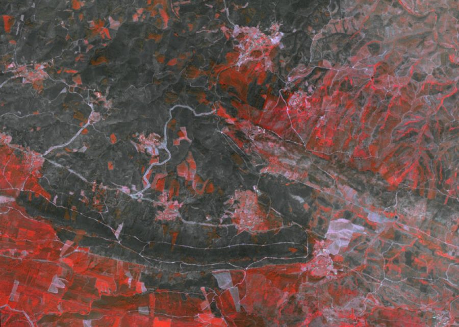
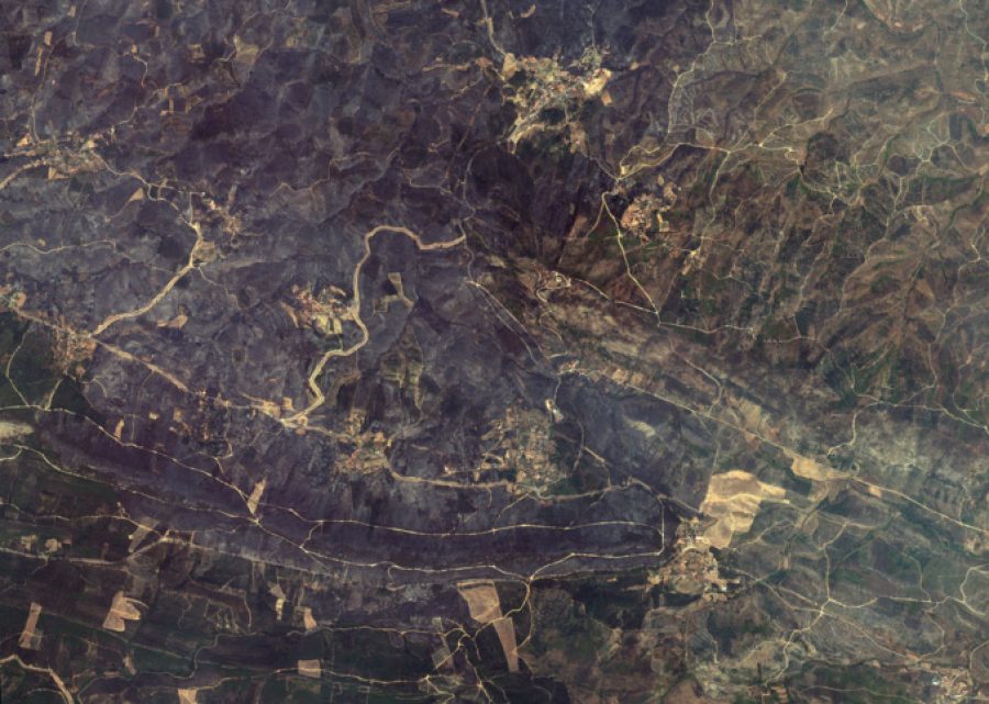
Animated GIF showing a satellite image in real colour and false colour as well as the derived delineation map of the burned areas in one particular Area of Interest (AOI) ©European Space Imaging
Emergency Satellite Imagery Activation
Multiple fires began on 20 July, 2019 near Castelo Branco under suspicious circumstances. Hours later, the Copernicus EMS Rapid Mapping Module was activated in order to provide First Estimate Product and Delineation maps to National Command for Relief Operations – National Authority for Civil Protection in Portugal.
24 Hour Emergency Service Provider
The Copernicus EMS placed the satellite imagery tasking order with European Space Imaging just after midnight, local time on 22 July. European Space Imaging is able to accept emergency orders 24/7 as it partners with Maxar Technologies to fulfil after hours tasking requests. The ability to place an overnight order and have the first available satellites collect images in the morning means that maps that are essential to the firefighting and evacuation efforts can be delivered and utilised within hours.
GAF AG, a valued partner of European Space Imaging, was relied upon for rapidly producing the necessary maps based off of the collected imagery. The images were used for Delineation maps which provide an assessment of the event impact and extent. For this, it is necessary to have images acquired as soon as possible after an emergency event.
Multi-Spectral Imagery for Emergencies
European Space Imaging operates the WorldView Satellite Constellation as is passes over Europe and North Africa. The images delivered for this emergency activation were from the WorldView-3 satellite. WorldView-3 is able to collect 30cm resolution images with up to 16 spectral bands including 8 SWIR bands. The importance of these spectral bands cannot be overstated. Applications include analysing plant health, identifying material composition or in forest fire situations, identifying burned areas.
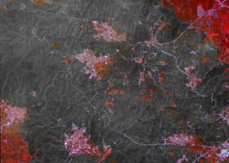
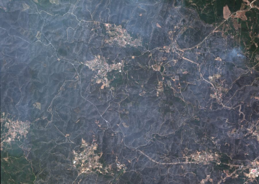
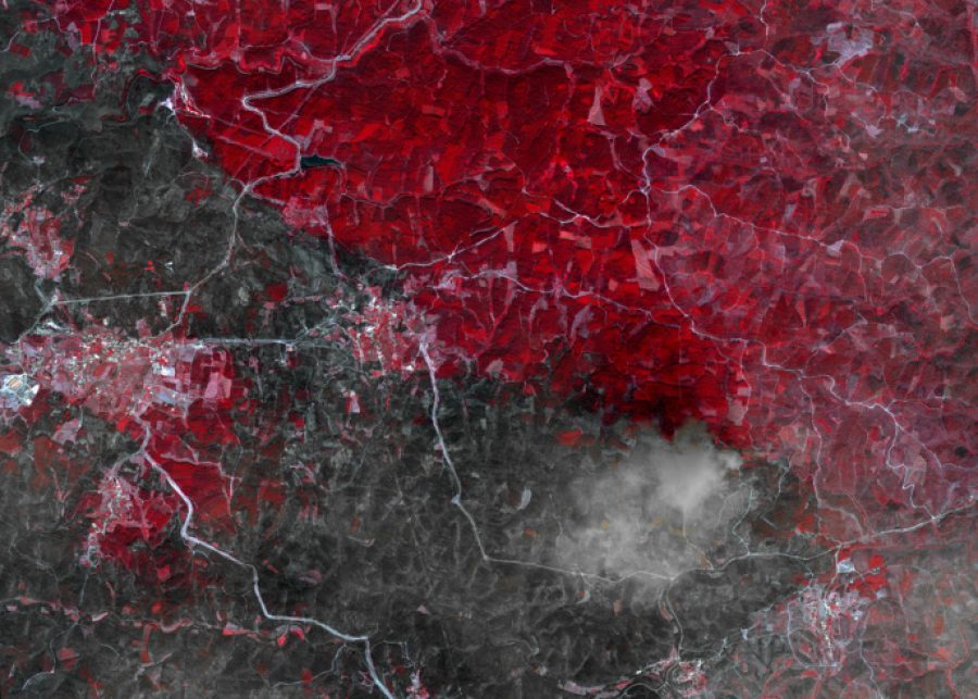
The interactive sliders below depict natural and false colour satellite imagery of 4 AOIs within the wildfire. In the false colour images, red denotes healthy vegetation while the black/grey areas are burned vegetation. The distinction is much clearer than the natural colour images.
©European Space Imaging
European Space Imaging will continue to monitor the ongoing fires in Portugal and work closely with the Copernicus EMS to fulfil any more emergency satellite imagery needs.
To learn more and download the map products, visit Copernicus EMS.
Related Stories

Earth Observation Turns Ecological Targets into Measurable Outcomes: How Satellite Imagery Supports Compliance with Europe’s Nature Restoration Regulation
The EU’s Nature Restoration Regulation (NRR) entered into force in 2024 and set legally binding targets to restore degraded ecosystems across Europe. With National Restoration Plans due in September 2026, Member States face an urgent question: how do you map, plan and monitor restoration across millions of hectares in a consistent, verifiable way? Earth Observation (EO) – and Very High Resolution (VHR) multispectral satellite imagery in particular – is increasingly the answer.

EUSI Upgrades German Ground Segment to Enable Europe’s Fastest Request-to-Receive Satellite Intelligence via Secure Web and API Platform for Defence and Emergency Agencies
European Space Imaging (EUSI) announced a major upgrade of its satellite ground segment and cloud infrastructure, further accelerating its industry-leading satellite tasking and intelligence delivery capabilities through the secure ATOM™ web and API platform. The platform, in combination with EUSI’s Rapid Satellite Intelligence (RSINT) program, enables satellite tasking up to 30 minutes before image acquisition and delivery of imagery within 15 minutes of collection.


Maritime Domain Awareness in European Arctic Regions With VHR Satellite Intelligence
With the Arctic warming nearly four times faster than the average, the ice in the High North is melting and the sea is becoming increasingly navigable. In 2025 alone, 1812 vessels entered the Arctic Polar Code area, which is a 40% increase since 2013 when data collection began. While this rise in traffic presents potential commercial opportunities, more vessels also mean more risks to people and resources.

Seeing More in a Single Day: The Value of Intraday Satellite Collections
Imagine a convoy moves between 08:00 and 11:00. Or morning clouds clear by 14:00, revealing new activity. Or a structure appears at 09:30 that wasn’t visible at 07:00. If you’re working with once-daily satellite passes, you miss all of this. With intraday collections, you see it happen.




