
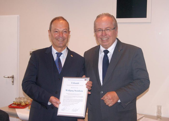

Dr Wolfgang Steinborn Awarded DDGI’s Golden Badge of Honor

Dr Wolfgang Steinborn, a Senior Advisor at European Space Imaging, has been awarded the prestigious golden badge of honor by the German Umbrella Organization for Geo-Information (DDGI). This elite award is highly exclusive – only three people have been decorated with it since the organization was established in 1994, almost 25 years ago.

The award recognizes Dr Steinborn’s tireless work for DDGI promoting the field of geo-information in Germany and Europe. For many years he was the European Delegate of DDGI, and one of four members of the Executive Committee of the European Umbrella for Geo-Information (EUROGI).

Dr Wolfgang Steinborn is decorated with the Golden Badge of Honor by Udo Stichling, President of the German Umbrella Organization for Geo-Information.

“I am very pleased to be recognized with this award for my life’s work in the geo-information business,” said Dr Steinborn. “I have a strong belief in the high value of location based information to the prosperity of Europe and, indeed, the world, and I certainly hope that my efforts to facilitate greater use of that information have made some difference to people and the environment. I am also fascinated by the valuable contribution nowadays’ satellite observation can make to the sector.”

Dr Steinborn was a member of the DDGI founding board, and has been a committed representative ever since. He has campaigned throughout Europe, and served in several advisory committees to the German government and the European Commission. The golden badge of honor recognizes that through his efforts, Dr Steinborn has shaped the organization’s achievements in German and European politics and business, and commemorates him for it.

“My sincere congratulations go to Wolfgang for this well-deserved accolade,” said Adrian Zevenbergen, Managing Director of European Space Imaging. “We are proud to have his knowledge and experience assisting our activities in this dynamic industry.”

The previous recipients of the honor include DDGI’s Founding President Klaus Barwinski and Prof. Gerd Buziek, the Director of Communications and Public Affairs at Esri Germany.

Related Stories

wildfire

VHR Satellite Images for Wildfire Monitoring 

High temperatures are breaking records, vegetation is drying up, and catastrophic wildfires are raging across Europe. Emergency responders are already turning to satellite imagery for fire monitoring and damage analysis – but few know its full potential. Near Real-Time (NRT) capabilities deliver critical images just 15 minutes after collection. Intraday imaging captures a fire as it develops throughout the day. And 8-band multispectral imagery lets responders see through haze, light fog, and other atmospheric conditions – including wildfire smoke itself.

Read More »
Nature Restoration

Earth Observation Turns Ecological Targets into Measurable Outcomes: How Satellite Imagery Supports Compliance with Europe’s Nature Restoration Regulation

The EU’s Nature Restoration Regulation (NRR) entered into force in 2024 and set legally binding targets to restore degraded ecosystems across Europe. With National Restoration Plans due in September 2026, Member States face an urgent question: how do you map, plan and monitor restoration across millions of hectares in a consistent, verifiable way? Earth Observation (EO) – and Very High Resolution (VHR) multispectral satellite imagery in particular – is increasingly the answer.

Read More »
satellite antenna

EUSI Upgrades German Ground Segment to Enable Europe’s Fastest Request-to-Receive Satellite Intelligence via Secure Web and API Platform for Defence and Emergency Agencies

European Space Imaging (EUSI) announced a major upgrade of its satellite ground segment and cloud infrastructure, further accelerating its industry-leading satellite tasking and intelligence delivery capabilities through the secure ATOM™ web and API platform. The platform, in combination with EUSI’s Rapid Satellite Intelligence (RSINT) program, enables satellite tasking up to 30 minutes before image acquisition and delivery of imagery within 15 minutes of collection.


Read More »



