

Planetek Italia and European Space Imaging Support Earthquake Emergency
- European Space Imaging
European Space Imaging and its long-term partner Planetek Italia sprang into action to support disaster relief efforts by supplying the first available very high-resolution satellite imagery to emergency services and the media just hours after the recent earthquake struck Italy.
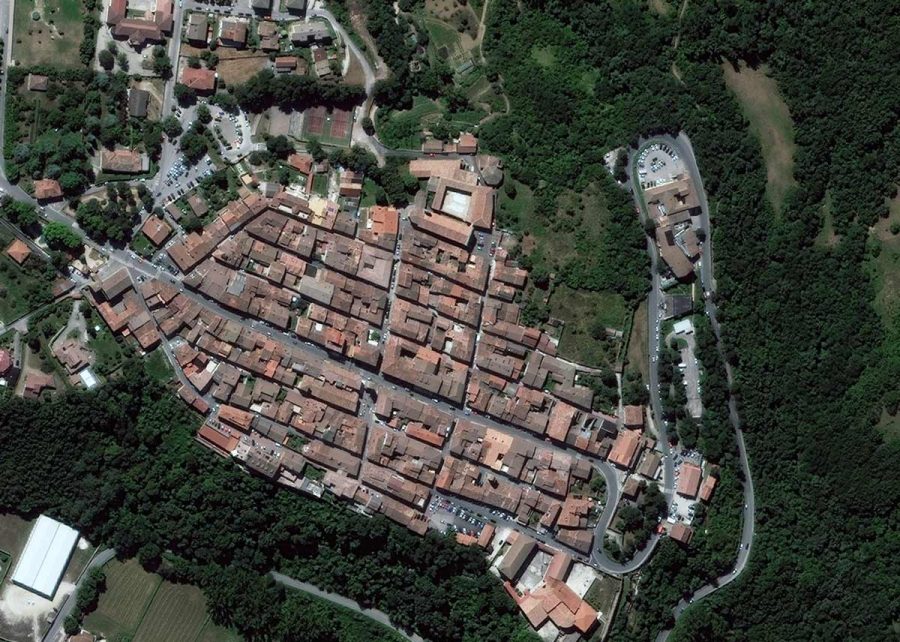
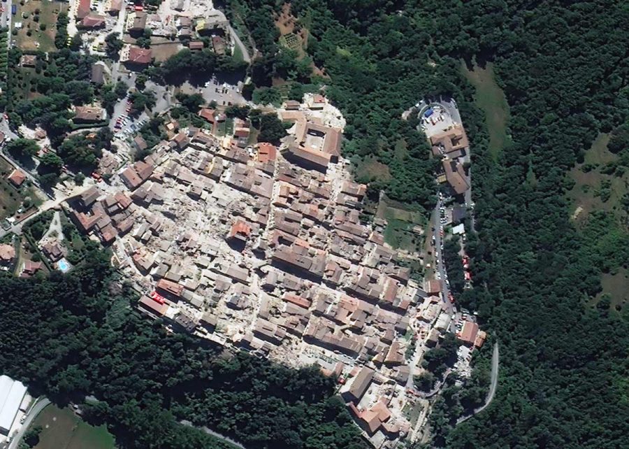
The imagery was captured by the WorldView-2 satellite over the affected region showing the extent of the damages caused. The high-resolution imagery was immediately made available to the Italian Emergency Services.
The earthquake hit at around 3:30 am of August 24th, 2016, some 100 km northeast of Rome. The earthquake of magnitude 6.2 severely damaged several towns and killed hundreds of people in central Italy. The towns of Amatrice, Accumoli, Pescara del Tronto and Arquata del Tronto have been completely devastated.
Early in the morning of August 24th, Planetek Italia asked European Space Imaging, Europe’s leading provider of very high-resolution satellite imagery to collect imagery of affected areas through its local ground station. A few hours after the earthquake, around 10:20 UTC, European Space Imaging acquired and provided the first image of Amatrice, Italy in 40 cm resolution.
Planetek Italia, based in Italy is a major supplier of satellite imagery and mapping services in Italy. In the case of the earthquake they supplied the first imagery to emergency services.
“The ability of satellites to collect images over large areas, the view from above of the areas affected by an emergency and the comparison with previous images helps to quickly recognize the changes, and understand where to address first aid”, says Giovanni Sylos Labini, CEO of Planetek Italia.
As the leading supplier of very high-resolution satellite imagery in their region European Space Imaging knows the importance of making imagery available quickly.
“When a catastrophe happens in Europe we can react quickly. Our dedicated staff give highest priority to support disaster relief efforts in a fast and pragmatic way. We are proud of our team and happy to help when we can”, says Michaela Neumann, Director of Sales and Marketing, European Space Imaging.
The image was provided to the Humanitarian OpenStreetMap Team (HOT) and has been made available to anyone who wants to contribute to the detection and mapping of buildings and infrastructures damaged and destroyed. This activity will provide updated information of great support to Institutions and emergency services during the emergency and after.
The European Union immediately alerted the Copernicus EMS team, which is providing the Italian Civil Protection damage assessment satellite maps for the affected area, based on European Copernicus Sentinel satellites.
Related Stories

Earth Observation Turns Ecological Targets into Measurable Outcomes: How Satellite Imagery Supports Compliance with Europe’s Nature Restoration Regulation
The EU’s Nature Restoration Regulation (NRR) entered into force in 2024 and set legally binding targets to restore degraded ecosystems across Europe. With National Restoration Plans due in September 2026, Member States face an urgent question: how do you map, plan and monitor restoration across millions of hectares in a consistent, verifiable way? Earth Observation (EO) – and Very High Resolution (VHR) multispectral satellite imagery in particular – is increasingly the answer.

EUSI Upgrades German Ground Segment to Enable Europe’s Fastest Request-to-Receive Satellite Intelligence via Secure Web and API Platform for Defence and Emergency Agencies
European Space Imaging (EUSI) announced a major upgrade of its satellite ground segment and cloud infrastructure, further accelerating its industry-leading satellite tasking and intelligence delivery capabilities through the secure ATOM™ web and API platform. The platform, in combination with EUSI’s Rapid Satellite Intelligence (RSINT) program, enables satellite tasking up to 30 minutes before image acquisition and delivery of imagery within 15 minutes of collection.


Maritime Domain Awareness in European Arctic Regions With VHR Satellite Intelligence
With the Arctic warming nearly four times faster than the average, the ice in the High North is melting and the sea is becoming increasingly navigable. In 2025 alone, 1812 vessels entered the Arctic Polar Code area, which is a 40% increase since 2013 when data collection began. While this rise in traffic presents potential commercial opportunities, more vessels also mean more risks to people and resources.

Seeing More in a Single Day: The Value of Intraday Satellite Collections
Imagine a convoy moves between 08:00 and 11:00. Or morning clouds clear by 14:00, revealing new activity. Or a structure appears at 09:30 that wasn’t visible at 07:00. If you’re working with once-daily satellite passes, you miss all of this. With intraday collections, you see it happen.




