

European Space Imaging Partner in Newly Launched MARSAT Consortium
- European Space Imaging
MARSAT consortium announced it is ready to provide innovative space-based applications using satellite-derived information for the maritime and coastal industry. MARSAT’s main goal is to create integrated satellite-based services to improve safety and efficiency in shipping, offshore industries, emergency response and rescue operations.
“MARSAT is an ambitious project, which brings together competence of specialists in satellite data provision and analysis, IT and the maritime industry. This team will lay the ground for improved decision making for shipping route optimization, offshore planning and maintenance as well as emergency events”, said Dr. Knut Hartmann, Project Coordinator MARSAT, EOMAP GmbH & Co KG
MARSAT is a consortium of six German companies, EOMAP GmbH & Co KG, Drift & Noise Polar Services GmbH, European Space Imaging GmbH, Institute of Shipping Economics and Logistics (ISL), SevenCs GmbH, TRENZ AG, and is funded by BMWi, the German Federal Ministry for Economic Affairs and Energy. The kick-off meeting was successfully held at the end of August 2016 at the German Aerospace Center (DLR) Space Administration in Bonn, Germany and marked the starting point of this 2.5 year project.
MARSAT – Satellite Services for the Maritime Industry
“The use of satellite data and Earth Observation products in the maritime world has an enormous potential. We are at the very beginning, just starting to get a glimpse at the possibilities and huge benefits these innovative technologies will offer.” Dr. Nils Meyer-Larsen, Project Manager, ISL
The technical goals of MARSAT are to create and integrate operational services to allow the maritime industry to take advantage of the most up-to-date satellite information in their day-to-day work. This requires setting up an efficient IT infrastructure to share, integrate and implement satellite-derived data quickly and efficiently from various satellite sources. Services such as ice detection and drift, obstruction and bathymetry mapping will be integrated in maritime information systems so that, e.g., shipping routes can be optimized, up-to date information made available for rescue or emergency events, and base data provided for environmental and coastal use cases within user friendly applications.
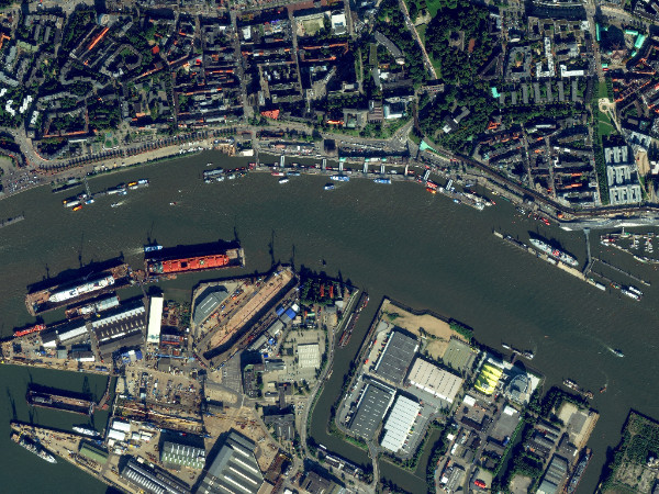
Port facilities in Hamburg, Germany imaged by WorldView-2, 3 Oct 2015.
“European Space Imaging believes in the potential of the Earth Observation industry to offer integrated, more user-friendly and sustainable services to the maritime industry. By uniting satellite-based information services into existing maritime information structures we will create better services and provide more safety in the industry,” says Adrian Zevenbergen, Managing Director, European Space, Imaging.
MARSAT is a dynamic and steadily growing network of data suppliers, users and academia, and cooperation is more than welcome.
Related Stories

GEOSeries: Turning Satellite Data into Actionable Intelligence for Critical Energy Infrastructure
See how satellite imagery can make critical infrastructure monitoring more frequent, targeted and efficient. Monitoring hundreds or thousands of kilometres of pipelines, power lines and other critical infrastructure traditionally requires extensive field inspections, vehicle patrols or aerial surveys. Satellite-based monitoring offers a different approach: regularly analysing large networks, identifying potential risks and directing teams to the locations that require attention.
Gallery: Wildfires Across Europe in August 2026
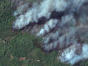
The first week of August brought heatwaves, droughts, and wildfires. Here are satellite images showing the destruction.
VHR Satellite Images for Wildfire Monitoring
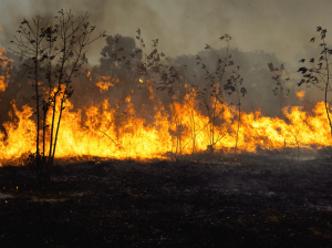
High temperatures are breaking records, vegetation is drying up, and catastrophic wildfires are raging across Europe. Emergency responders are already turning to satellite imagery for fire monitoring and damage analysis – but few know its full potential. Near Real-Time (NRT) capabilities deliver critical images just 15 minutes after collection. Intraday imaging captures a fire as it develops throughout the day. And 8-band multispectral imagery lets responders see through haze, light fog, and other atmospheric conditions – including wildfire smoke itself.

Earth Observation Turns Ecological Targets into Measurable Outcomes: How Satellite Imagery Supports Compliance with Europe’s Nature Restoration Regulation
The EU’s Nature Restoration Regulation (NRR) entered into force in 2024 and set legally binding targets to restore degraded ecosystems across Europe. With National Restoration Plans due in September 2026, Member States face an urgent question: how do you map, plan and monitor restoration across millions of hectares in a consistent, verifiable way? Earth Observation (EO) – and Very High Resolution (VHR) multispectral satellite imagery in particular – is increasingly the answer.