
PRESS UPDATE: European Space Imaging signs contract with Maxar to sell SecureWatch and EarthWatch

European Space Imaging today signed a contract with Maxar Technologies, a trusted partner and global innovator in Earth intelligence and space infrastructure, to offer SecureWatch and EarthWatch to customers based in Europe, North Africa and the Commonwealth of Independent States (CIS countries).

The innovative and industry-leading products are subscription-based services that provide customers online and offline access to global content layers through one interface. The products provide instant access to Maxar’s WorldView satellite imagery and geospatial data while empowering customers with the flexibility to only pay for content that they consume via a per gigabyte price model. Customers can select fit-for-purpose geodata, whether they need the latest image, a time series, or mosaics, from anywhere in the world with no concurrent user limit.

Commercial and civil government customers subscribe to EarthWatch for use cases like monitoring changes of assets like structures and pipelines, and proactively preparing for and managing emergency situations with the best information commercially available. Defence and intelligence customers use SecureWatch to access and analyze geospatial information in support of national security. SecureWatch also provides access to MDA’s RADARSAT-2 synthetic aperture radar (SAR) data for all weather location monitoring.

“We are very pleased to be able to add these diverse and industry leading products to our portfolio” said Adrian Zevenbergen, Managing Director European Space Imaging. “We strive to continue to be the European leader of VHR optical satellite imagery, providing rapid delivery to our customers. The addition of EarthWatch and SecureWatch further enhances our ability to do this.”

“SecureWatch and EarthWatch provide users with an easy way to access and extract insights from Maxar’s industry-leading imagery and geodata,” said Jeff Culwell, Maxar’s Chief Product Officer. “We are pleased that our long-time partner European Space Imaging will be incorporating our products to help their customers make critical decisions.”

Related Stories

Banner saying: "Webinar: Turning Satellite Data into Actionable Intelligence for Critical Energy Infrastructure"

GEOSeries: Turning Satellite Data into Actionable Intelligence for Critical Energy Infrastructure

See how satellite imagery can make critical infrastructure monitoring more frequent, targeted and efficient. Monitoring hundreds or thousands of kilometres of pipelines, power lines and other critical infrastructure traditionally requires extensive field inspections, vehicle patrols or aerial surveys. Satellite-based monitoring offers a different approach: regularly analysing large networks, identifying potential risks and directing teams to the locations that require attention.
Read More »
wildfire

VHR Satellite Images for Wildfire Monitoring 

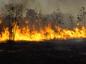
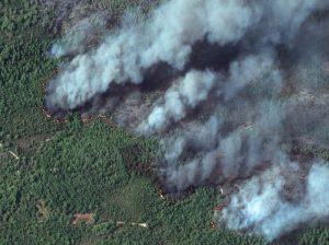
High temperatures are breaking records, vegetation is drying up, and catastrophic wildfires are raging across Europe. Emergency responders are already turning to satellite imagery for fire monitoring and damage analysis – but few know its full potential. Near Real-Time (NRT) capabilities deliver critical images just 15 minutes after collection. Intraday imaging captures a fire as it develops throughout the day. And 8-band multispectral imagery lets responders see through haze, light fog, and other atmospheric conditions – including wildfire smoke itself.

Read More »
Nature Restoration

Earth Observation Turns Ecological Targets into Measurable Outcomes: How Satellite Imagery Supports Compliance with Europe’s Nature Restoration Regulation

The EU’s Nature Restoration Regulation (NRR) entered into force in 2024 and set legally binding targets to restore degraded ecosystems across Europe. With National Restoration Plans due in September 2026, Member States face an urgent question: how do you map, plan and monitor restoration across millions of hectares in a consistent, verifiable way? Earth Observation (EO) – and Very High Resolution (VHR) multispectral satellite imagery in particular – is increasingly the answer.

Read More »