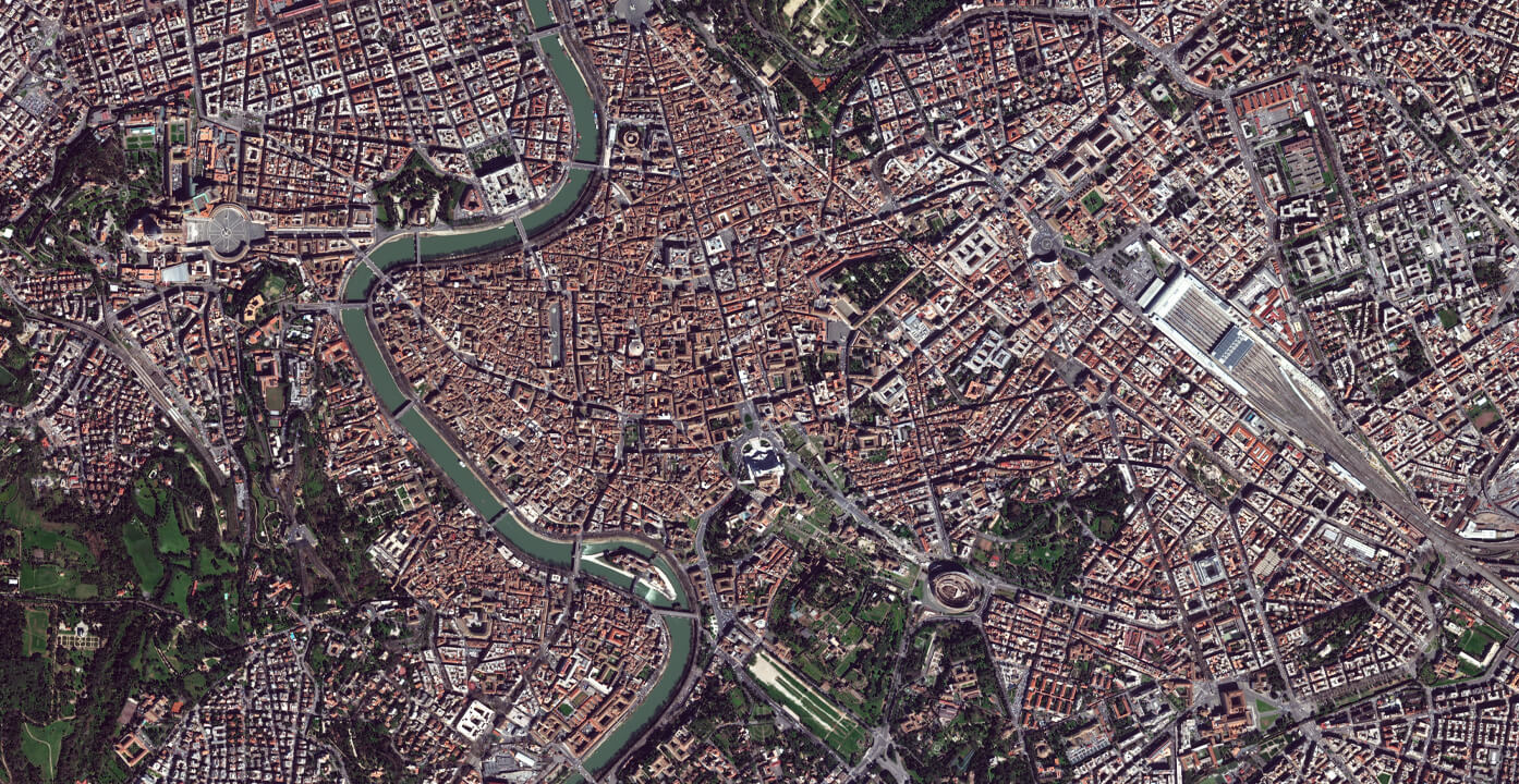
Access to a vast collection of hundreds of sqkm in unprecedented detail
The World’s highest capacity for 30 cm VHR imagery
10
Satellites in the constellation
6
milions sqkm of imagery per day
15
up to 15 daily opportunities
With 10 satellites now in orbit, EUSI has nearly doubled its ability to execute large-scale mapping projects across Europe. The Maxar Constellation can collect an impressive 6 million sq km of imagery per day, including up to 3.6 million sq km of 30 cm-class imagery. This enhanced capacity presents a significant opportunity to supplement or even replace traditional aerial mapping campaigns across the continent.
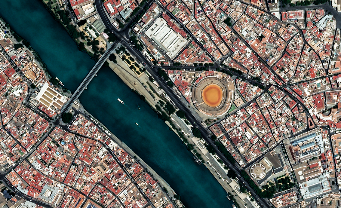
When you rely on map data to make decisions about your community or serve your customers, you need accurate information that meets your requirements. Maxar’s Vivid and Dynamic imagery basemaps feature the latest innovations in mosaicking, color balancing and image processing to provide stunning high-resolution, high-accuracy image layers available off the shelf or configured on demand. Imagery basemaps provide a virtually seamless, consistent image layer over large areas to support mapping, visualization, and analytics. Spend less time processing data and more time executing your mission.
UrbanPix HD is a curated dataset of key European metro areas collected at least once per year in triple stereo, facilitating the HD dynamic mosaics. The list of cities is curated by a joint effort from the EU Commission, DLR and EUSI and include climate neutral cities and rapidly developing urban areas.
This dataset is key in promotions towards the EU Commission, ESA, and sustainability/urban development customers.
This website uses cookies to improve your experience. We'll assume you're ok with this, but you can opt-out if you wish.DENYCUSTOMIZEACCEPT ALL
Privacy & Cookies Policy
Privacy Overview
This website uses cookies to improve your experience while you navigate through the website. Out of these cookies, the cookies that are categorized as necessary are stored on your browser as they are essential for the working of basic functionalities of the website. We also use third-party cookies that help us analyze and understand how you use this website. These cookies will be stored in your browser only with your consent. You also have the option to opt-out of these cookies. But opting out of some of these cookies may have an effect on your browsing experience.
Necessary cookies are absolutely essential for the website to function properly. This category only includes cookies that ensures basic functionalities and security features of the website. These cookies do not store any personal information.
Any cookies that may not be particularly necessary for the website to function and is used specifically to collect user personal data via analytics, ads, other embedded contents are termed as non-necessary cookies. It is mandatory to procure user consent prior to running these cookies on your website.
Architecture of ResNet34-UNet model
UNet architecture for semantic segmentation with ResNet34 as encoder or feature extraction part. ResNet34 is used as an encoder or feature extractor in the contracting path and the corresponding symmetric expanding path predicts the dense segmentation output.
Architecture of VGG16-UNet model
UNet architecture for semantic segmentation with VGG16 as the encoder or feature extractor. VGG16 is used as an encoder or feature extractor in the contracting path and the corresponding symmetric expanding path predicts the dense segmentation output.
Architecture of ResNet34-FCN model
In this model, ResNet34 is used for feature extraction and the FCN operation remains as is. The feature of ResNet architecture is exploited where just like VGG, as the number of filters double, the feature map size gets halved. This gives a similarity to VGG and ResNet architecture while supporting deeper architecture and addressing the issue of vanishing gradients while also being faster. The fully connected layer at the output of ResNet34 is not used and instead converted to fully convolutional layer by means of 1×1 convolution.
Architecture of VGG16-FCN model
In this model, VGG16 is used for feature extraction which also performs the function of an encoder. The fully connected layer of the VGG16 is not used and instead converted to fully convolutional layer by means of 1×1 convolution.