Imagery Specifications
Geospatial professionals need their satellite data pre-processed differently depending upon how they plan to use it, which is why we offer so many different image product options. If you have knowledge of remote sensing and are interested in our product parameters, you will find them detailed below. But if you are new to satellite imagery, contact our friendly customer support team and they will help you choose the right product.
What's your focus?
Precise georeferencing
Geolocational accuracy up to
5 meters
More Spectral Bands
Wavelength detection between 450 nm and 2273 nm
Higher Resolution
30 cm resolution images without any resampling
Pixel Resolution
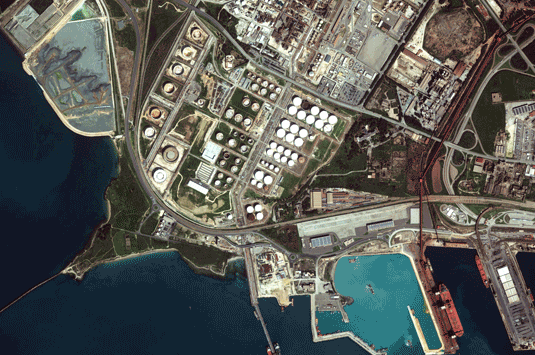
The pixel resolution of a satellite image defines how far you can “zoom in” on it, and how small the objects are that you can see. A low resolution satellite image will be able to show you the course of a river, but a very high resolution satellite image will be able to zoom right in on the leisure boat cruising along it.
European Space Imaging is able to supply the highest resolution satellite images available. Each pixel in one of our 30 cm images captures an area on the ground of 30 x 30 cm, which makes smaller objects clearly visible.
Ortho ready imagery is our most popular product, and is perfect for users who want to do their own orthorectification. Ortho ready imagery is projected to a plane using map projections and datum; radiometric and sensor corrections are also applied. Geometric corrections project the image to a constant base elevation, which is calculated on the average terrain elevation per order polygon, or can be supplied by the customer.
Ortho ready imagery can be ordered directly from the archive, or can be freshly acquired by a satellite to your exact project specifications. Your image file will be accompanied by the relevant image support data files, including all the relevant metadata and shape files.
Please note that if your order is collected by the satellite in more than one strip one product will be delivered per scene.
Orthorectified imagery is fully processed and ready to be integrated into your GIS workflow. Orthorectified images provide a perfect base for creating and revising mapping and GIS databases or for registering existing feature layers. They can be used for change detection and other analytical applications that require a high degree of absolute accuracy. It comes with all the geolocation information applied, including the refined ephemeris, attitude, rotation, terrain elevation, and alignment to the map projection. Multiple images can be mosaicked to minimize seamlines, and tonal balancing can be applied if desired.
It is available in two different accuracy specifications –
MAPPING: No ground control points
PRECISION: With ground control points
Orthorectified imagery can be ordered directly from the archive, or freshly acquired by a satellite to your exact project specifications. Your image file will be accompanied by the relevant image support data files, including all the relevant metadata and shape files.
Stereo imagery enables users to generate their own digital elevation models (DEM), create 3D visualisations, and accurately extract features. Stereo products are collected during the same orbit and acquired at angles optimal for stereo viewing and manipulation.
It has a high three-dimensional accuracy, resolution, and a large swath size. This enables more accurate mapping, terrain modeling results, and helps to alleviate feature identification issues caused by shadows or snow.
The vast majority of our clients order ortho ready stereo imagery, which has radiometric, sensor, and geometric corrections applied. Basic imagery is also available upon request.
Stereo imagery can be ordered directly from the archive, or can be freshly acquired by a satellite to your exact project specifications. Your image file will be accompanied by the relevant image support data files, including all the relevant metadata and shape files.
* Please note that archive imagery from older satellites may have a lower CE90 accuracy, as will images collected at more than 30° off-nadir – our customer support team will let you know if this is the case with your chosen image.


