Large-Scale Mapping With Satellites
Cover the whole country in 15 cm images within days or weeks

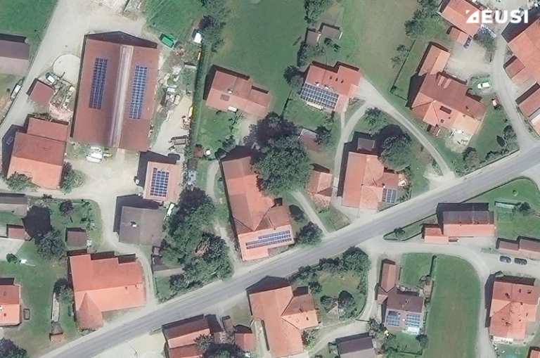
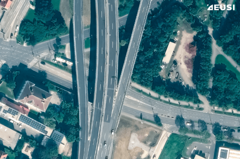
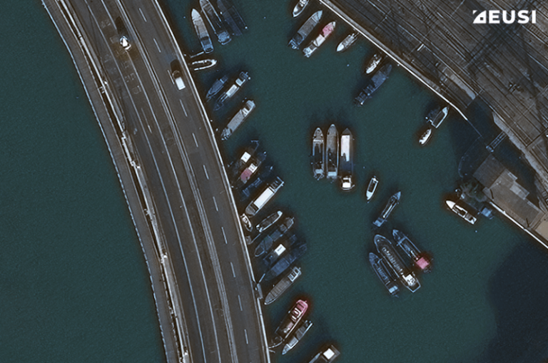
Up to 15 cm resolution
To identify small features like individual trees or road marks.
High capacity
High revisit rate ensures fast country collection and low cloud cover.
Homogenous data
With consistent shadow directions, colour balance, and crop conditions.
COMPARE AERIAL VS SATELLITE MAPPING
Aerial surveys face challenges from wind and turbulence, which can significantly reduce flyable days. Satellites are more flexible. Images are collected at different times of the day, using real-time weather data to avoid clouds. The collection plan is finalised a few minutes before the satellite pass so the impact of weather is minimal.
🔎 For a mapping project, we collected an entire area of Greece with <=5% snow/cloud cover per satellite image, and <=2% snow/cloud cover per tile (3×4 km).
Both satellites and aerial platforms meet geolocation accuracy standards required for LPIS and civil mapping. Advances in satellite positioning and processing techniques ensure precise alignment with CAP compliance demands.
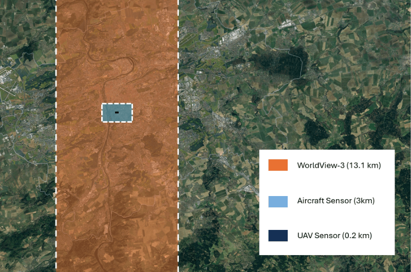
Satellites collect vast swaths of land in minutes, covering areas that aircraft would need days or weeks to map. Moreover, satellites continuously build archives of recent and historical imagery, which can sometimes supplement fresh tasking.
🔎 Over 3 million sqkm at 30–50 cm GSD are added to the available archive every day.
Both data platforms can offer 4 or 8-band multispectral imagery as well as stereo collections. The WorldView satellites collect 8 VNIR bands as a standard unlike other satellite or aerial sensors, and Legion satellites include two Red Edge bands (695–715 nm and 730–750 nm), closely aligned with Sentinel-2’s Red Edge wavelengths.
Satellites excel in accessing difficult regions such as borders, conflict zones, remote islands, and rugged geographies like mountain ranges. They offer unrestricted, non-intrusive and consistent data collection where aerial surveys may face logistical and safety challenges.
Satellite data is delivered in manageable file sizes thanks to efficient collection methods, reducing processing times to hours or days. Aerial imagery’s large, overlapping datasets require extensive time to process and even longer to mosaic.
CASE STUDIES

GREECE | 2023
Country coverage for updating LPIS
For updating the Land Parcel Identification System (LPIS), TotalView partnered with EUSI to deliver 30–50 cm satellite imagery of the whole area of Greece to the Hellenic Cadastre. The images were divided in 3×4 km tiles for easier processing, with <2% snow/cloud cover per tile. The project used Maxar WorldView satellites.
The main challenge for aerial mapping in Greece has been its geography. The total area of the country is 132,000 km2, which includes 6,000 islands and islets scattered in the Greek Seas. Moreover, approximately 80% of the land area is covered by mountains or hills.
- Remote islands: The vast number of islands, many of which are small and remote, makes aerial coverage costly and time-consuming.
- Cloud and snow cover: Mountainous areas are often covered in clouds or snow.
- Diverse landscape: Complex landscape types, such as sand dunes, deltas, wetlands, forests or mountains, require the ability to differentiate between various features.
The secret to cloud-free country coverage
We manually planned each collection only minutes before the pass to minimise the cloud cover, snow cover, and sun glint in coastal areas. This resulted in <=2% snow/cloud cover per tile.
Accurate feature identification
All images had a 30-50 cm resolution, which allowed to accurately measure and identify objects, vehicles, or vegetation.
Remote areas
Satellites can capture remote islands that would otherwise require dedicated flights there and back. Moreover, whereas with aerial or drone imagery you have to stitch together images collected at different times and during different weather conditions, satellites bring a more homogenous overview.
The Hellenic Cadastre received:
- 132,000 km2 collected
- 1319 satellite images divided in 13,460 tiles
- 30–50 cm native resolution
- 1.25 m RMSE accuracy
- 4 spectral bands
- <5% snow/cloud cover per image
- <2% snow/cloud cover per tile
- INSPIRE-compliant data
SOUTHERN GERMANY | 2024
Rapidly filling aerial data gaps
In autumn 2024, EUSI completed a mapping project for a land surveying authority in Southern Germany. The authority typically uses aerial imagery for updating their LPIS, but because of the unpredictable weather conditions in 2024, the aircraft was able to fly only part of the planned time. To quickly finish the project before snow cover, they looked to fill in the gaps with Very High Resolution satellite imagery.
The decision to use satellite imagery was made in the last quarter of 2024 when the weather conditions were challenging. This would require all possible flexibility from EUSI to finalise the collections.
EUSI implemented the Intelligent Collection Planning process, a solution that combines advanced planning software with human interventions. The automated system suggested collections and an expert from EUSI reviewed them every 15 minutes and made adjustments to optimise them. EUSI were able to collect the whole area cloud-free, at 30 cm HD resolution under a tight timeline.
- 6,588 km2 collected
13 satellite images
30 cm HD (40–50 cm native)
cloud-free imagery
4 multispectral bands


HAMBURG | 2024
15 CM DYNAMIC BASEMAP
Urban areas require more granular data than rural coverages. That’s why a land surveying authority from Hamburg requested fresh 15 cm imagery in September 2024.
- 15 cm resolution
- cloud-free imagery
- 4 multispectral bands
- colour-balanced mosaic
The total area of the city-state is 755 km2.
To ensure a cost-effective solution, EUSI used a mixture of recent archive imagery plus new collections to cover the AOI. All four images had 0% cloud cover and a native resolution of 30 cm, which was further enhanced to 15 cm HD. The basemap is a completely cloud-free colour-balanced mosaic with 4 multispectral bands, and was provided to the customer within one week.
sCHLESWIG-hOLSTEIN | 2024
cOMPLETE REGIONAL COVERAGE
For a land surveying authority in Schleswig-Holstein, Germany, EUSI collected satellite imagery during vegetation period (April to September). The mapping agency received 4-band (B, G, R, NIR1) ortho-ready pansharpened imagery at 30 cm HD resolution.
In Northern Germany, clouds pose a significant challenge, and it’s essential to make the most out of cloud-free days. Notably, 60% of the area was captured in a single day using Maxar WorldView-3.
Additionally, cloud patching was carried out on the imagery. As a result, the overall cloud cover was less than 10%.

CHOOSE A TRUSTED EUROPEAN PROVIDER
Selecting a European data provider ensures alignment with EU standards and CAP-specific requirements. European Space Imaging (EUSI) combines technical expertise, local responsiveness, an intimate understanding of European policies and decades of success with the JRC CwRS project.
Flexible Delivery Models
Providing tailored solutions, including data-only products, in-house ortho-mosaics, or partnerships with third-party processors.
Access to Advanced SATELLITES
Utilising the WorldView Legion satellites for rapid tasking and high-capacity data acquisition.
Dedicated Project Management
Offering personalised support to ensure seamless integration of satellite data into LPIS workflows.
Institutional Partnerships
Trusted collaborator with the EU Commission JRC, ESA, DLR, and multiple national and regional mapping agencies.


