

Supporting European Land Management Policies via Copernicus VHR2021
Skye Boag, Marketing Manager
EUSI have delivered over one million sq km of cloud free satellite data to the Copernicus VHR2021 campaign in cooperation with Airbus and GAF AG. The VHR coverage provides a complete geospatial overview of Europe’s land and environment conditions every three years, arming European institutions and governments with data insights that bolster strategic environmental and land management policies. Collection began in May 2020 and was completed in September 2022, observing the demanding coverage requirements.
What is the Very High Resolution 2021 (VHR2021) Campaign?
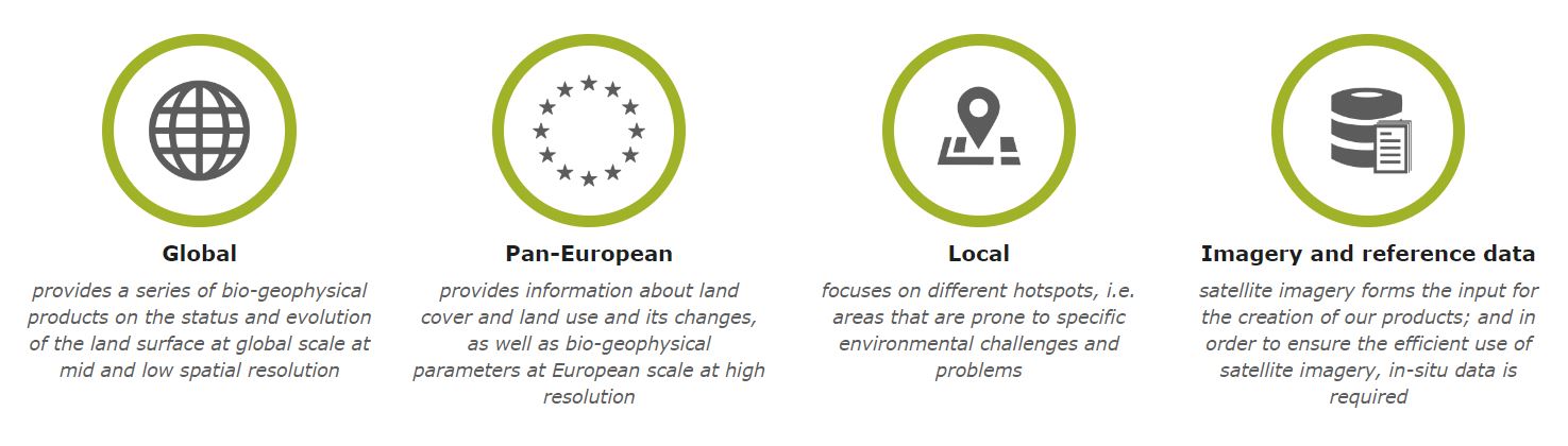
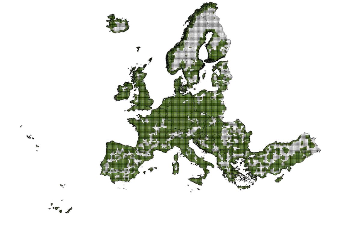
Copernicus is the European Union’s Earth observation programme managed by the European Space Agency (ESA). The objective of the VHR2021 coverage is to provide the Copernicus Service Providers and other users authorised by the European Commission with a complete coverage of the region EEA-39 countries with EO Very High Resolution optical data. The supply of data is then embedded in PRISM and operated through the systems in use for other Copernicus datasets. The VHR2021 dataset will be used primarily by the Copernicus Land Monitoring Service for its Pan-European and Local components which provides geographical information on land cover and related variables supporting applications in a variety of domains such as spatial planning, forest management, water management, agriculture and food security.
Figure: Overview of the main components of the Copernicus Land Service. Source: https://land.copernicus.eu/
Meeting Demanding Technical Requirements
The Copernicus Programme provides, on a sustainable basis, the use of multiple source data in a reliable and timely service to environment and security. Whilst some of this data comes directly from the Sentinels, other data at higher resolutions must be obtained from the Copernicus Contributing Missions (CCM’s). EUSI has been a long-standing provider to the CCM’s and was able to utilise this experience to meet the strict technical requirements of the VHR2021 coverage. The most demanding requirement of the project was the delivery of 100% cloud free, cloudshadow and haze-free coverage. Furthermore, there was a priority AOI requirement attached to 70% of the coverage collection that had to be delivered at 2 m spatial resolution. In addition, a minimum of 70% of the total coverage of the campaign, equating to approximately 4.2 million sq km of data, had to be acquired during the core year 2021. Lastly, the data acquired by the various satellites had to conform to the homogenous coverage requirements and minimise coverage fragmentation as much as possible.
Delivering the Data
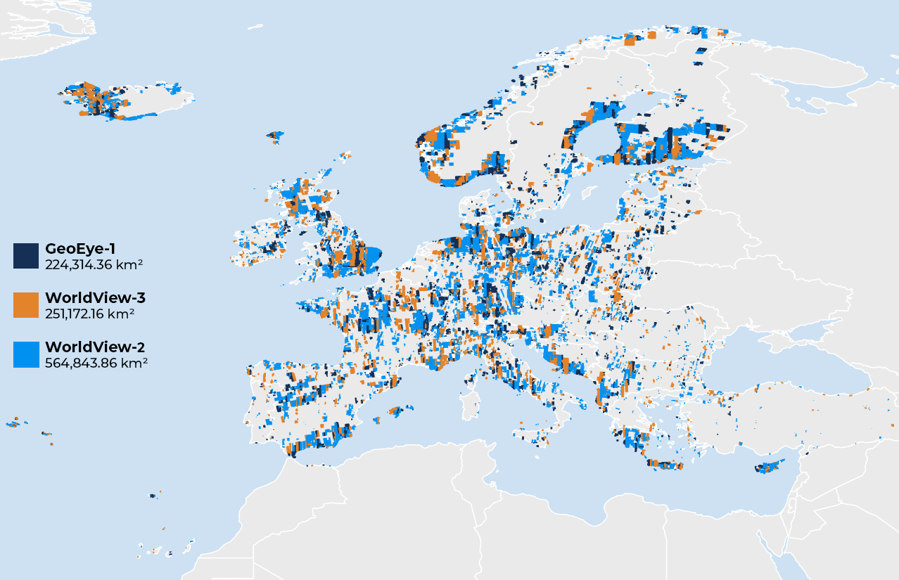
A total of six million sq kilometres of multispectral data at resolutions 2 – 4 m was to be acquired for VHR2021. Several of the priority AOI’s are infamous for high cloud cover and required a flexible acquisition strategy that was managed by the Operations Team at EUSI meticulously. Real time weather assessments were taken into account, and tasking plans were adjusted up to 15 minutes before acquisition to maximise the collection efficiency of the Maxar WorldView constellation. Of the entire coverage, EUSI collected and delivered just over one million sq km of imagery with from WorldView-2, WorldView-3 and GeoEye-1 satellites; 96% of the data was delivered in 2021, while the remaining 4% was delivered in 2022, exceeding coverage requirements.
Related Stories

Gallery: Wildfires Across Europe in August 2026
The first week of August brought heatwaves, droughts, and wildfires. Here are satellite images showing the destruction.

VHR Satellite Images for Wildfire Monitoring
High temperatures are breaking records, vegetation is drying up, and catastrophic wildfires are raging across Europe. Emergency responders are already turning to satellite imagery for fire monitoring and damage analysis – but few know its full potential. Near Real-Time (NRT) capabilities deliver critical images just 15 minutes after collection. Intraday imaging captures a fire as it develops throughout the day. And 8-band multispectral imagery lets responders see through haze, light fog, and other atmospheric conditions – including wildfire smoke itself.

Earth Observation Turns Ecological Targets into Measurable Outcomes: How Satellite Imagery Supports Compliance with Europe’s Nature Restoration Regulation
The EU’s Nature Restoration Regulation (NRR) entered into force in 2024 and set legally binding targets to restore degraded ecosystems across Europe. With National Restoration Plans due in September 2026, Member States face an urgent question: how do you map, plan and monitor restoration across millions of hectares in a consistent, verifiable way? Earth Observation (EO) – and Very High Resolution (VHR) multispectral satellite imagery in particular – is increasingly the answer.

EUSI Upgrades German Ground Segment to Enable Europe’s Fastest Request-to-Receive Satellite Intelligence via Secure Web and API Platform for Defence and Emergency Agencies
European Space Imaging (EUSI) announced a major upgrade of its satellite ground segment and cloud infrastructure, further accelerating its industry-leading satellite tasking and intelligence delivery capabilities through the secure ATOM™ web and API platform. The platform, in combination with EUSI’s Rapid Satellite Intelligence (RSINT) program, enables satellite tasking up to 30 minutes before image acquisition and delivery of imagery within 15 minutes of collection.




