
Open Access Data
We are committed to providing high-quality, Very High Resolution (VHR) Earth observation data to innovative users through some of Europe’s leading Earth observation open data programmes.
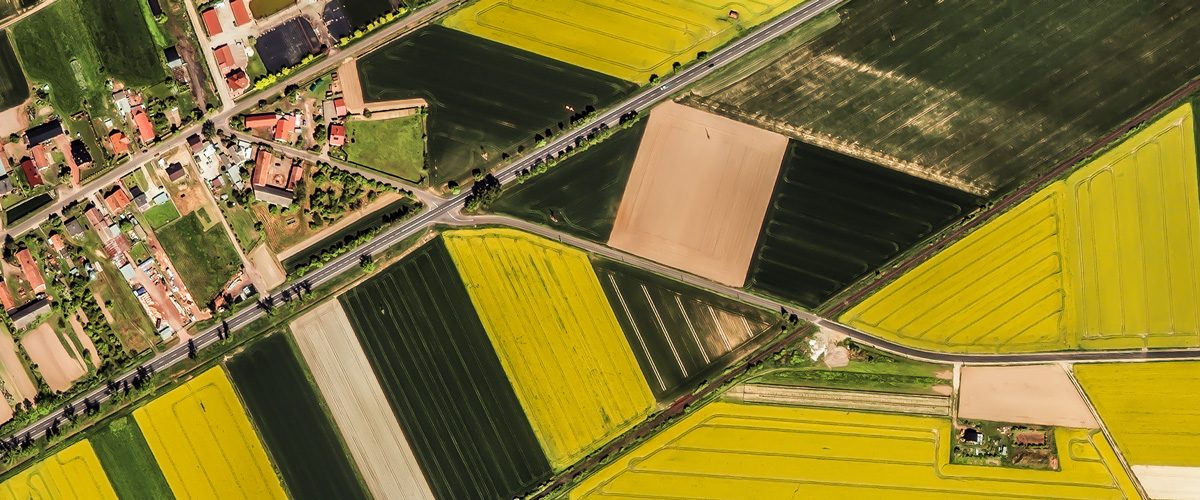
Open Data For a better world
Copernicus contributing missions
ESA
Earthnet Programme
Green Deal Promotion
By European Space Imaging
Since our inception in 2002, WorldView data provided by European Space Imaging has played a key role in open data access programmes with far-reaching applications in:
- Emergency Services
- Environmental Initiatives
- Climate Change
- Maritime Surveillance
- Border Security
- Land Use
We believe in the power of Very High Resolution (VHR) satellite imagery to create a safer, cleaner and more productive world.
For more information about WorldView satellite imagery and open data access, please contact us at opendata@euspaceimaging.com
Want To Try out our data?
Download sample imagery to see how it fits into your workflow.
Copernicus contributing missions
Complementing the Sentinels, the Copernicus Contributing Missions (CCM) provide data from third-party satellite operators to support Copernicus, the Earth Bbservation component of the EU’s Space Programme. WorldView imagery plays a key role in many Copernicus Services, including emergency management, maritime surveillance, border security, and land monitoring.
Copernicus provides free access to a wide range of Earth observation data collected by the Sentinel satellites, contributing missions, and in situ sensors. The programme also offers access to a variety of products and services derived from these data for eligible users. To explore the available datasets, view the Data Portfolio (https://dataspace.copernicus.eu/data-collections) for more information.
Sentinel Imagery
The Copernicus free and open data policy makes Sentinel satellite imagery freely available to users worldwide through the Copernicus Data Space Ecosystem (CDSE).
https://dataspace.copernicus.eu/data-collections
Core Data Sets
These are large, pre-defined data sets, covering the needs of the Copernicus services and other Earth Observation activities. Access is granted to users within the following categories:
- Copernicus Services
- European Union Institutions: Agencies, bodies and contractors defined in EU Treaties
- EU Member State Public Authorities– Any person, institution or contractor having public or administrative duties; Public research and academic organisations
- Union Research Projects– Participants in a research project financed under the Union research programmes
- International Organisations– Any person or institution (government or non-government) that is registered with the UN and involved in humanitarian or environmental activities
Additional information ca be found here: https://dataspace.copernicus.eu/explore-data/data-collections/copernicus-contributing-missions/ccm-user-categories
Users wishing to access CCM data from the core datasets should register here: https://dataspace.copernicus.eu/. To access CCM data through the Rapid Response Desk, users should register here: https://info.rapidresponse.copernicus.eu/.
Copernicus Contributing Missions Website – Copernicus Contributing Missions | Copernicus Data Space Ecosystem
ESA Earthnet Programme
In addition to providing users with data from its own Earth observing satellites, the European Space Agency (ESA) uses its multi-mission ground systems to process, archive and distribute data from other satellites – so called Third Party Missions. Very High Resolution (VHR) imagery from the WorldView Constellation can be accessed by researchers and developers for non-commercial applications.
Academics, scientists, researchers and qualifying start-ups are eligible to access data from ESA Third Party Missions for non-commercial use.
Hopeful users should apply to the ESA portal and submit a project proposal. A response typically takes less than 2 weeks.
Green Deal Promotion
By European Space Imaging
The European Commission has taken a bold stance in building framework for carbon neutrality by 2050 with ambitious benchmarks by the year 2030. European Space Imaging wants to be a part of the solution by helping start-ups, small businesses and researchers realize their innovative ideas.
European Space Imaging has access to billions of square km of VHR imagery dating back to 1999. For this promotion, a subset of data covering Europe and it’s surrounding regions will be made available to eligible applicants.
Successful applicants could receive up to 200 square km of imagery from this data set.
A shapefile containing the available AOIs for this promotion can be downloaded from the following FTP url.
ftp://edu-shape-view:K3DpTd7a9k@80.155.2.44/edu_shape_view.zip
Research oriented institutions and small companies in a European Union member state who are working towards solutions that contribute to carbon neutrality goals are eligible to apply for the data.
If you are in the EU and have a project related to helping the environment, we want to hear from you.
Hopeful users should apply here and submit a project proposal. A response typically takes less than 2 weeks.
Are you in research or Education?
Find out how you can get up to 80% discount on VHR imagery for any project.




