Sun Glint Can Ruin Satellite Imagery. How Do We Avoid It?
- Zuzana Hajkova, Content Marketing Coordinator, EUSI
Sun glint occurs when sunlight reflects off water or another reflective surface at the satellite sensor, creating a bright glare in the image. That can make it impossible to extract useful information from satellite imagery. What do we do to minimise its impact?
What is sun glint?
Sun glint is the reflection of light in satellite or aerial imagery. It can look like a bright glare or blurry streaks of light, often obscuring the underlying features and making it challenging, if not impossible, to extract useful information from the data. Therefore, sun glint in satellite images is a major problem for most remote sensing projects.
This optical phenomenon occurs when a satellite collects an image over a reflective surface, such as:
- body of water (ocean, lake, or even a small pond)
- solar panel
- metal roof
- greenhouse
The reflection can vary in intensity, depending on the angle of the sun, the viewing angle of the satellite, or the roughness of the water’s surface. The calmer the water, the sunnier the day, and the lower the sun elevation, the higher the risk of sun glint occurring.
The science of water reflection
If a body of water was perfectly smooth and calm, it would act like a mirror, and sun glint would look like a series of glares along the satellite’s orbit. But that is usually not the case, as water is influenced by gusts of wind and currents, forming waves or underwater movements. This results in sun glint appearing as a vast area of blurry, glimmering streaks of light, changing the colour and texture of the water in the image.
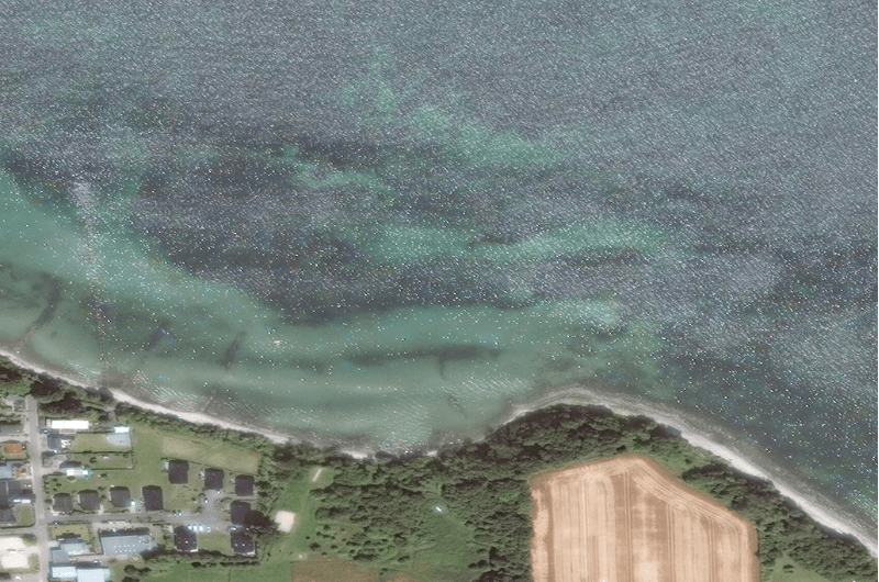
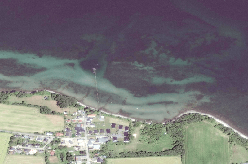
THE ROLE OF SUN ELEVATION
Sun glint is most pronounced when the sun is low on the horizon, either in the morning or evening. Latitude can also play a role, as the farther in the north and the south you go, the lower the sun is in winter. This angle of illumination increases the likelihood of sunlight reflecting off the surface directly into the satellite sensor.
REGIONAL DEPENDENCE
Between the latitudes of 30 °N and 30 °S, sun glint can be seen throughout the whole year. However, the phenomenon is not rare at higher latitudes either. Usually from March to September, sun glint occurs much farther north – in Italy, Germany, Norway, or even above the Arctic Circle – and much farther south.
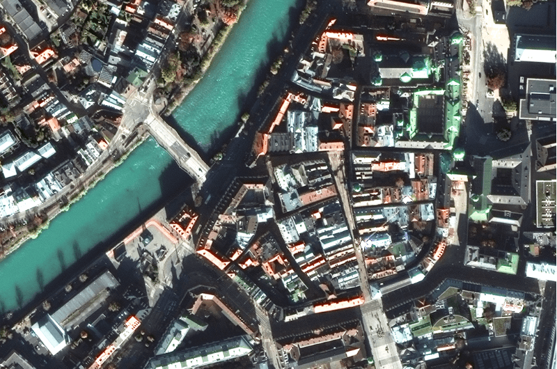
The angle of the satellite sensor plays a crucial role
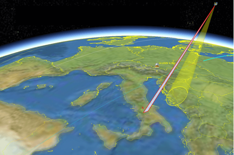
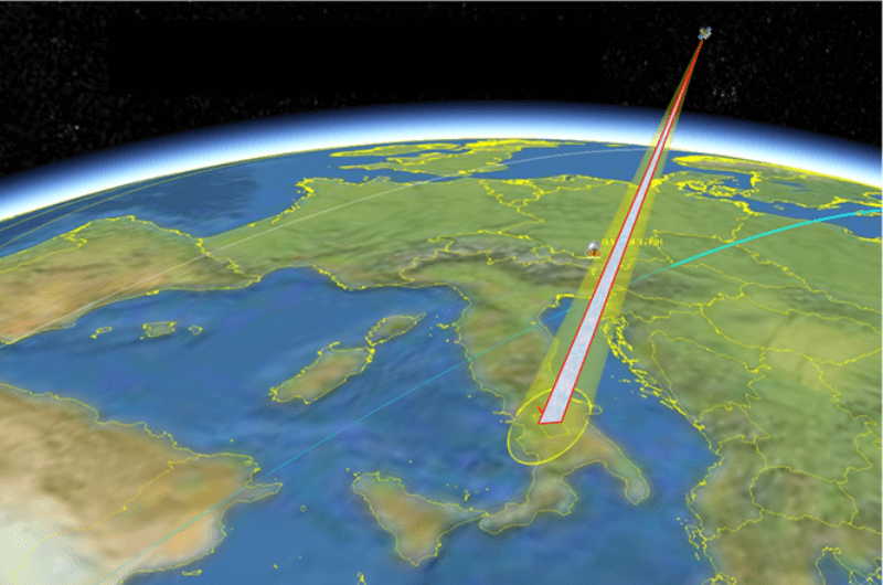
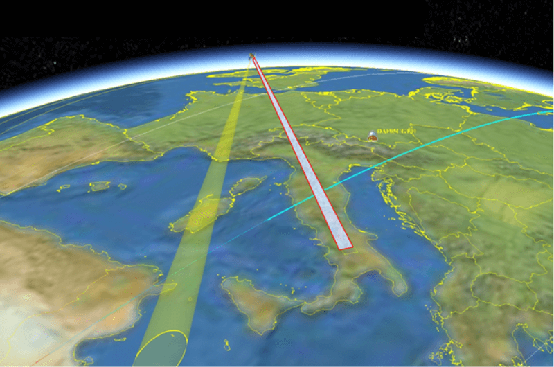
Sun glint occurs when sunlight reflects off the surface at the same angle that the satellite sensor observes it. By adjusting the angle at which the satellite and its sensor image a target, it is possible to reduce or even completely avoid sun glint in satellite images.
EUSI follows a specific procedure to minimise the impact of sun glint on image quality
We use Intelligent Collection Planning (ICP), a process that combines automated imagery collection planning with manual adjustments by experts for further quality and efficiency. If a collection is scheduled over a sun glint region, our newest collection planning system automatically adjusts the collection plan to ensure the satellite’s looking direction to the area of interest doesn’t point to a region prone to sun glint.
Additionally, we manually refine the timing and angle of the imaging. It is not possible to completely eliminate 100% of all sun reflection in the images, however, our approach allows us to provide high-quality data with a minimum impact of sun glint, meeting even the most stringent technical requirements.
Related Stories
Seeing More in a Single Day: The Value of Intraday Satellite Collections
Imagine a convoy moves between 08:00 and 11:00. Or morning clouds clear by 14:00, revealing new activity. Or a structure appears at 09:30 that wasn’t visible at 07:00. If you’re working with once-daily satellite passes, you miss all of this. With intraday collections, you see it happen.

GEOSeries: Maintaining Temporal Control of Developing Situations With Rapid Satellite Tasking and Intraday Imaging
In the fast-moving operational environments of security monitoring and emergency response, the value of satellite data is defined by when it arrives, not just its resolution or accuracy. This webinar explores how Dynamic Tasking enables users to access actionable data fast and operate within mission decision windows.
VHR Satellite Images Show Damage After Niscemi Landslide
In January 2026, Italy declared state of emergency after being hit by Cyclone Harry – a storm that brought 10-metre waves and torrential rains of over 300 mm in 48 hours. The most severely affected regions were Sicily, Calabria and Sardinia, with the damage in Sicily alone estimated to be more than 1.5 billion euros. EUSI collected Very High Resolution satellite imagery of the affected areas, including Niscemi – a Sicilian town hit by a massive landslide.

The Potential of WorldView Legion for the Safety and Security in Europe
In the ever-evolving landscape of global security, satellite imagery has become an indispensable tool for governments, organisations, and businesses worldwide. Many of them are now learning about the new opportunities that the six recently launched Vantor WorldView Legion satellites bring: higher border security, improved maritime surveillance, faster reaction to developing events, and much more.


