

Satellite Images of Morandi Bridge Collapse
- European Space Imaging
Satellite imagery supplied by European Space Imaging highlights the devastating extent of damage that was sustained to the Morandi Bridge as it collapsed during a violent storm on Tuesday.
Italian PM Guiseppe Conte has today declared a 12 month period of emergency as the death toll has risen to 39 people with a further 15 injured. Some 10,000 rescue workers are continuing to sift through the piles of concrete with sections of debris reaching three stories high in the search of finding remaining survivors. At least seven victims have already been pulled from the rubble alive. There are grave concerns that the remaining structure may collapse and this has lead to the evacuation of at least 630 people who reside near the bridge.
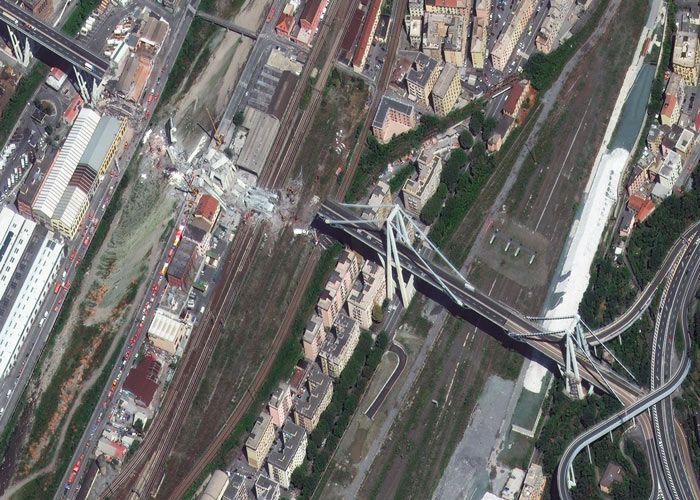
Satellite image at 30 cm resolution showing the collapsed section of Morandi Bridge in Genoa, Italy. The high quality of the data makes it possible to zoom in on the image and thereby identify the extent of the damage. 15/8/2018 by WorldView-4 © European Space Imaging
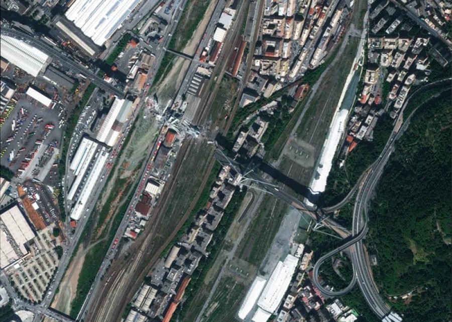
Due to the high resolution of the 30 cm satellite imagery released by European Space Imaging, we can identify a 300 meter convey of rescue vehicles at the rubble site along with a scattering of other vehicles around the perimeter totaling almost 100 vehicles. In addition several tent sites have been erected to service the crews and remaining survivors.
“Satellite Imagery is useful for first responders of any crisis to assess the scope of damage and get another view of the scene. It can also help to monitor and detect any changes that may be critical to minimising or even eliminating further catastrophe” said Adrian Zevenbergen, Managing Director of European Space Imaging. “The power of 30 cm resolution is that small objects can be identified making it an invaluable source of information for disaster management.”
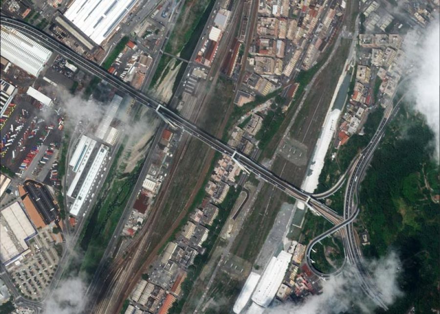
Satellite image at 30 cm resolution showing the full extent of the collapsed section of Morandi Bridge and surrounding disaster relief efforts in Genoa, Italy. 15/8/2018 by WorldView-4 © European Space Imaging. Morandi Bridge before the collapse at 30cm resolution. 8/07/2018 by WorldView-4 © 2018 European Space Imaging
Whilst the cause of the collapse is still unknown, disaster engineer experts can make use of very high resolution satellite images taken not only during the stages of rumble removal but also those captured before the collapse. Through analysis of the structural wreckage, experts can identify faults and weaknesses of the bridge that will assist their investigation to pinpoint and understand the cause of its constructional demise.
Related Stories

Gallery: Wildfires Across Europe in August 2026
The first week of August brought heatwaves, droughts, and wildfires. Here are satellite images showing the destruction.

VHR Satellite Images for Wildfire Monitoring
High temperatures are breaking records, vegetation is drying up, and catastrophic wildfires are raging across Europe. Emergency responders are already turning to satellite imagery for fire monitoring and damage analysis – but few know its full potential. Near Real-Time (NRT) capabilities deliver critical images just 15 minutes after collection. Intraday imaging captures a fire as it develops throughout the day. And 8-band multispectral imagery lets responders see through haze, light fog, and other atmospheric conditions – including wildfire smoke itself.

Earth Observation Turns Ecological Targets into Measurable Outcomes: How Satellite Imagery Supports Compliance with Europe’s Nature Restoration Regulation
The EU’s Nature Restoration Regulation (NRR) entered into force in 2024 and set legally binding targets to restore degraded ecosystems across Europe. With National Restoration Plans due in September 2026, Member States face an urgent question: how do you map, plan and monitor restoration across millions of hectares in a consistent, verifiable way? Earth Observation (EO) – and Very High Resolution (VHR) multispectral satellite imagery in particular – is increasingly the answer.


EUSI Upgrades German Ground Segment to Enable Europe’s Fastest Request-to-Receive Satellite Intelligence via Secure Web and API Platform for Defence and Emergency Agencies
European Space Imaging (EUSI) announced a major upgrade of its satellite ground segment and cloud infrastructure, further accelerating its industry-leading satellite tasking and intelligence delivery capabilities through the secure ATOM™ web and API platform. The platform, in combination with EUSI’s Rapid Satellite Intelligence (RSINT) program, enables satellite tasking up to 30 minutes before image acquisition and delivery of imagery within 15 minutes of collection.



